Crowdsourcing public perceptions of urban green space quality: A case study of Rembrandt park in Amsterdam
- 1. Vrije Universiteit Amsterdam
- 2. International Institute for Applied Systems Analysis
Description
City-dwellers are realizing the benefits of green spaces and are flocking to urban parks. City planners face the challenge of ensuring that urban green spaces are functional for all citizens. To make informed choices they need the right information and that is where the Mijn Park app can help.
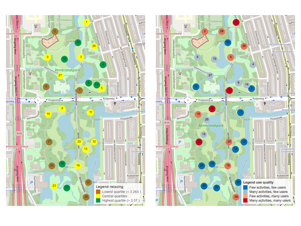
Research shows that when considering the social functions of urban green spaces, quality is just as important as quantity. It is easy enough to map how much green spaces there are, but how do we measure their quality? How do city planners ensure that the city’s green areas are attractive, accessible and inclusive – for everyone? The Vrije Universiteit Amsterdam in collaboration with the International Institute for Applied Systems Analysis developed Mijn Park, a mobile application that will help city planners do just that. As part of the LandSense Citizen Observatory, the ‘Mijn Park’ (My Park) app asks respondents to go to several locations in a park and give subjective responses to those locations. They are then further questioned about how they use the whole park and how much they would like to see certain changes made in the park. This information provides information that can help to inform decisions about any renovations or improvements to the park.
A pilot campaign was conducted in the summer of 2018 in Rembrandt park in Amsterdam and insights from the citizen-driven observations were shared with the Department of Planning and Sustainability of Amsterdam.
This dataset includes responses and photographs collected by 129 unique volunteers providing 377 observations in select locations across Rembrandt Park. The following files are available:
- _Preview MijnPark-Amsterdam-LandSense.png
- Attributes-MijnPark-Amsterdam-LandSense.csv
- MijnPark-Amsterdam-LandSense.csv
- MijnPark-Amsterdam-LandSense.geoJSON
- README.txt
This dataset is licensed under a Creative Commons Attribution 4.0 International. It is attributed to the LandSense Citizen Observatory, Vrije Universiteit (VU), Amsterdam and the International Institute for Applied Systems Analysis (IIASA).
This project has received funding from the European Union’s Horizon 2020 research and innovation programme under grant agreement no 689812.
Files
_Preview MijnPark-Amsterdam-LandSense.png
Files
(1.3 MB)
| Name | Size | Download all |
|---|---|---|
|
md5:4f9ce05e831fcb9aba6dace890dfd70a
|
662.2 kB | Preview Download |
|
md5:118d7c6134be3c7625a0311bc2d56f92
|
4.3 kB | Preview Download |
|
md5:bb2b11961eb1fff8733d71f1bd31a697
|
158.7 kB | Preview Download |
|
md5:0eb6c75bd176bbaa4f5f8303faaf6f8f
|
435.7 kB | Download |
|
md5:03887ee1508217ad43e371f7cc8e9881
|
786 Bytes | Preview Download |