ERA5 overviews complementing temperature measurements of ground-based Rayleigh lidars for the investigation of gravity waves generated by moving sources
Creators
- 1. Deutsches Zentrum für Luft- und Raumfahrt, Institut für Physik der Atmosphäre, Oberpfaffenhofen, Germany
Description
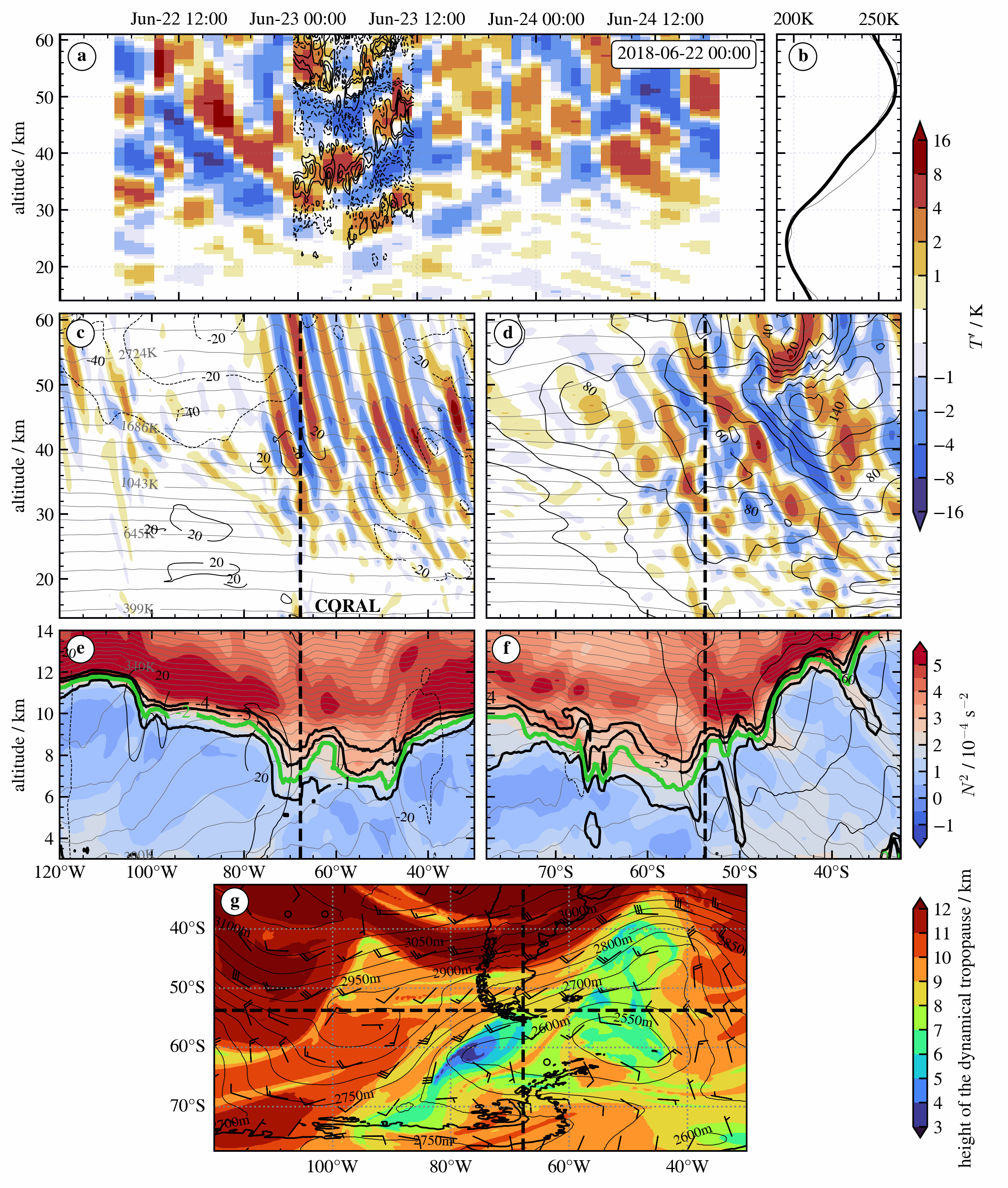
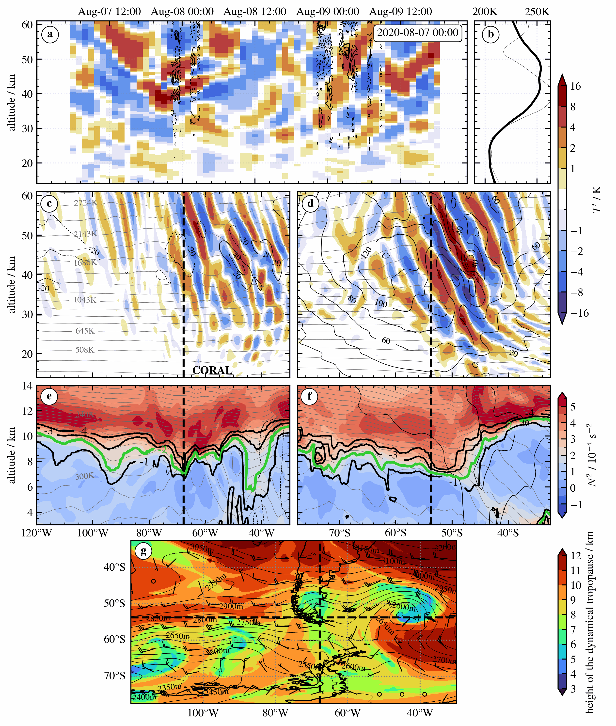
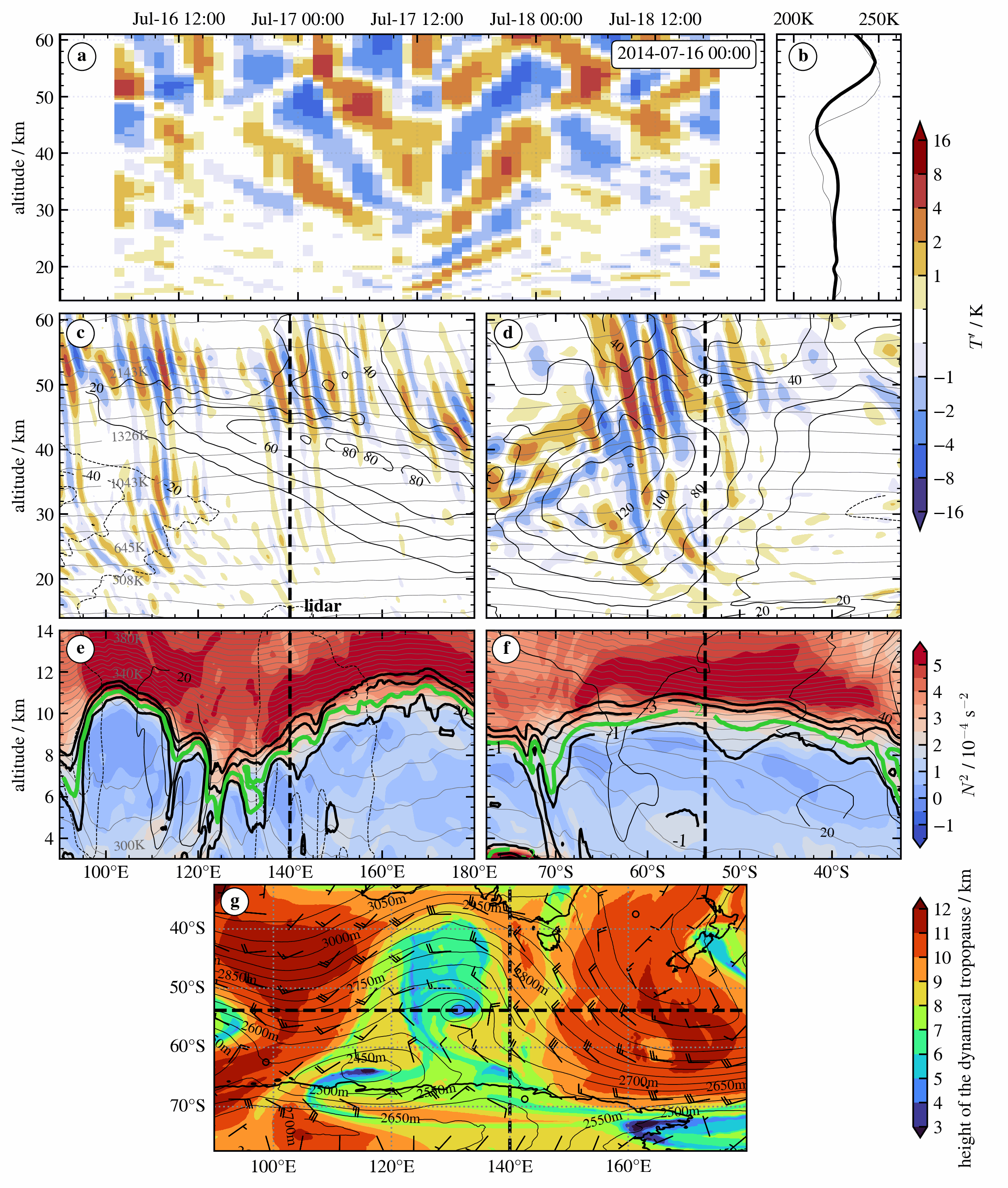
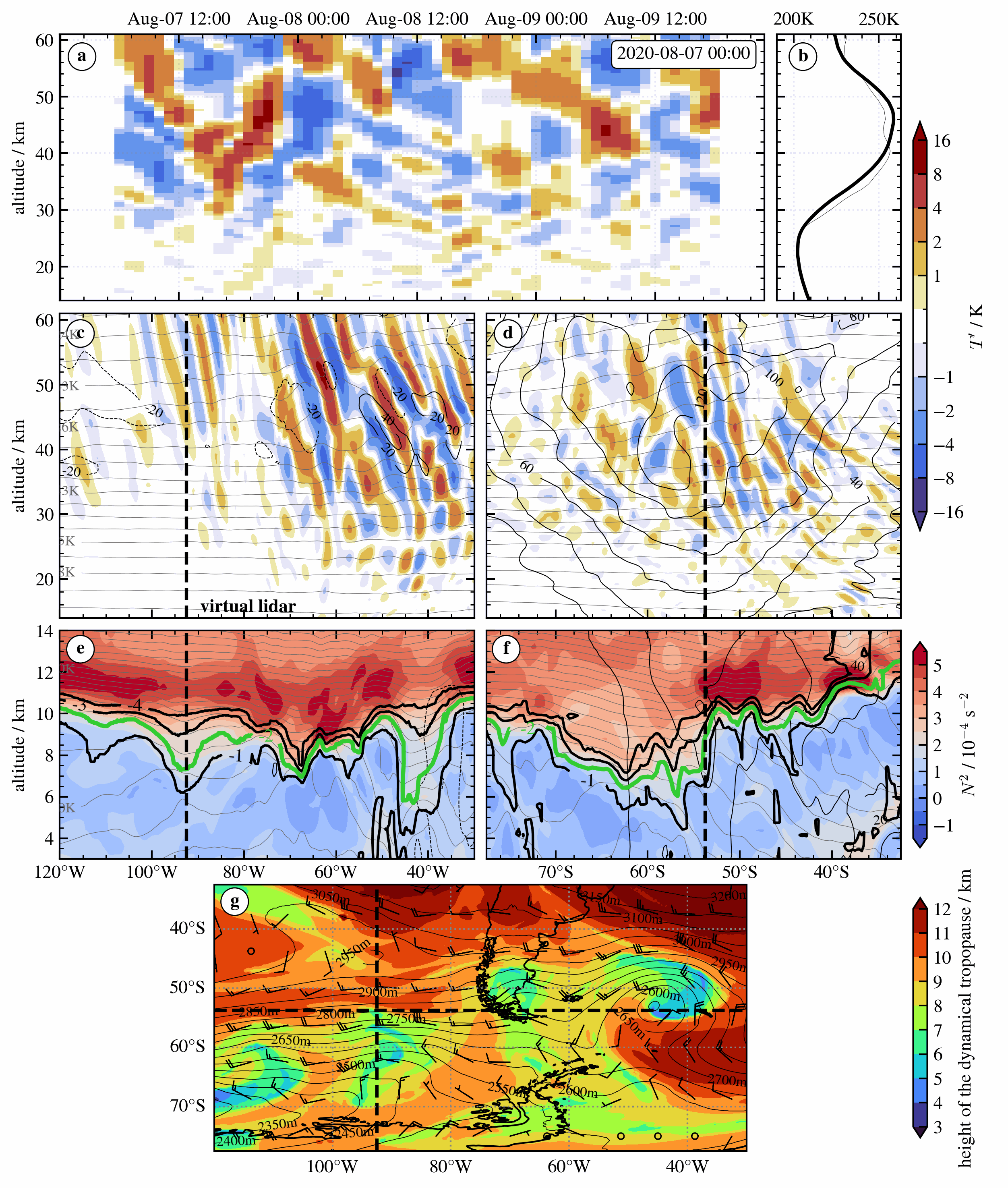
ERA5 overviews to associate stratospheric gravity waves in temperature measurements from vertically staring (zenith-pointing) ground-based Rayleigh lidars with atmospheric processes. Animations are for a virtual lidar location over the Southern Ocean during research flight RF25 of the DEEPWAVE campaign (July 17 to 19, 2014) and for the location of the COmpact Rayleigh Autonomous Lidar (CORAL) in the lee of the southern Andes. Here, the first overview is for the CORAL measurement from June 22 to 23, 2018. The second one is for the nightly measurements between August 7 and 9, 2020.
(a) and (b) emulate the measurement of a vertically staring ground-based lidar and show temperature perturbations after subtracting a temporal running mean of 12h (a) and the mean absolute temperature profile (b). Panels (c) and (d) are vertical sections of stratospheric 𝑇′ along sectors of the latitude circle (c) and meridian (d) of the virtual lidar location. (e) and (f) are corresponding vertical sections of thermal stability 𝑁2 (10−4 s−2, color-coded), potential temperature (K, thin grey lines), and potential vorticity (1, 2, 4 PVU: black, 2 PVU: green). Thin black lines in the vertical sections are zonal (d, f) and meridional (c, e) wind components (solid: positive, dashed: negative). Panel (g) is a horizontal section of the height of the 2 PVU surface (km, color-coded), geopotential height (m, solid lines) and wind barbs at the 850 hPa level. The black vertical line in (a) marks the time for (c)-(g) and dashed lines in (c)-(g) highlight the location of the virtual lidar and profiles in (a) and (b).
The provided NETCDF files contain the corresponding CORAL temperature measurements for the two periods with CORAL measurements in 2018 and 2020.
Files
era5_overview_coral_20180622.gif
Files
(207.9 MB)
| Name | Size | Download all |
|---|---|---|
|
md5:19a50459657bfeb366069841aa839349
|
771.6 kB | Download |
|
md5:e22b36d19a0a1f562954fced06f05daa
|
213.8 kB | Download |
|
md5:d165fb5e58e5a10206e6cd1b2e1dd360
|
457.3 kB | Download |
|
md5:07d824fe454f2f81eee61c28a4dbfaf6
|
55.3 MB | Preview Download |
|
md5:acae17985477811da35ae27ecdef8a7d
|
52.6 MB | Preview Download |
|
md5:7d0304f9c466dec1d0c6c39f24703383
|
49.6 MB | Preview Download |
|
md5:390fce9162ef555d10a57bb357ac1d29
|
48.9 MB | Preview Download |