Lake-TopoCat: A global Lake drainage Topology and Catchment database
Creators

- 1. Department of Geography & Geographic Information, University of Illinois Urbana-Champaign, Urbana, IL, USA
- 2. Department of Geosciences, Virginia Tech, Blacksburg, VA, USA
- 3. Department of Geography, University of California, Los Angeles, CA, USA
- 4. Institute of Industrial Science, The University of Tokyo, Tokyo, Japan
- 5. Nanjing Institute of Geography and Limnology, Chinese Academy of Sciences, Nanjing, China
- 6. Department of Geography and Geospatial Sciences, Kansas State University, Manhattan, KS, USA
- 7. Laboratoire d'Études en Géophysique et Océanographie Spatiales (LEGOS), Centre National d'Études Spatiales (CNES), Toulouse, France
- 8. Department of Earth, Marine and Environmental Sciences, University of North Carolina, Chapel Hill, NC, USA
Description
Contact: Md Safat Sikder (mssikder@illinois.edu), Jida Wang (jidaw@illinois.edu)
Citation
If you use Lake-TopoCat, please cite the following paper:
Sikder, M. S., Wang, J., Allen, G. H., Sheng, Y., Yamazaki, D., Song, C., Ding, M., Crétaux, J.-F., and Pavelsky, T. M., 2023. Lake-TopoCat: A global lake drainage topology and catchment dataset. Earth System Science Data, 15, 3483-3511, https://doi.org/10.5194/essd-15-3483-2023.
Data description and components
This version of Lake-TopoCat was constructed using the SWOT Prior Lake Database (PLD) v106 (Wang et al., 2023) lake mask and the 3-arc-second-resolution hydrography dataset MERIT Hydro v1.0.1 (Yamazaki et al., 2019). The drainage type of each PLD lake, such as isolated, inflow-headwater, headwater, flow-through, terminal, and coastal, was determined with assistance of MERIT Hydro-Vector (Lin et al., 2021), a high-resolution river network dataset with spatially-variable drainage densities.
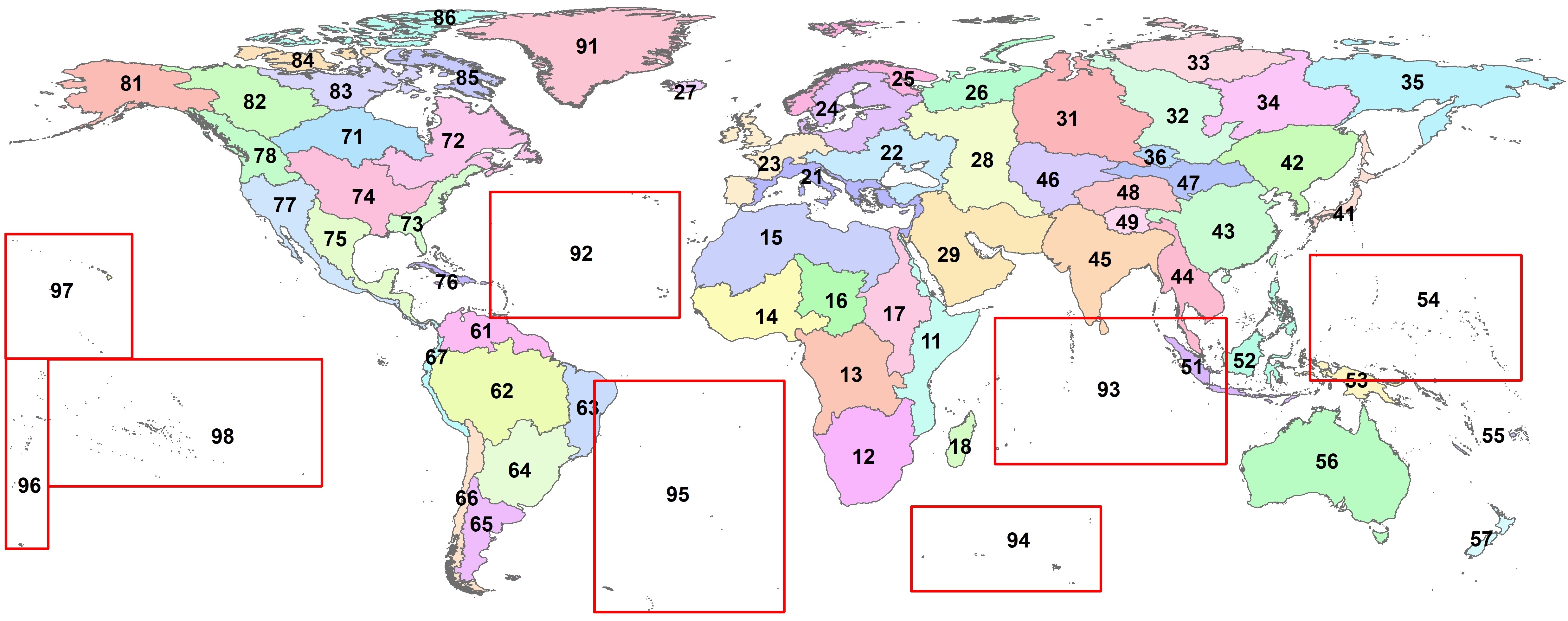
For convenience, the global landmass (excluding Antarctica) was partitioned to 68 Pfafstetter Level-2 basins or regions, and the Lake-TopoCat data products were also organized based on these 68 regions, with their region or basin IDs shown in the Fig. 'Pfaf2_basins.jpg', attached to this database.
Lake-TopoCat consists of five feature components, each with multiple attributes depicting lake drainage relationships. The five features are:
1. Lake boundaries: polygons of 5,893,363 PLD lakes, larger than 1 ha.
File name: Lakes_pfaf_xx where, 'pfaf_xx' indicates the Pfafstetter Level-2 basin ID (shown in Fig. 'Pfaf2_basins.jpg')
2. Lake outlets: points representing outlet or pour points of each individual lake. There are multiple outlets from a multifurcation lake. We identified 5,983,642 outlets for 5,893,363 lakes, where 83,819 lakes (~1.4% of the global lakes) show bi/multifurcation.
File name: Outlets_pfaf_xx
3. Unit catchment: boundary polygons of catchment defining the drainage areas between cascading (i.e., immediately upstream and downstream) lake outlets. The count of unit catchments equal to the count of lake outlets, and bifurcation or multifurcation lakes have multiple local catchments. In total, the delineated catchments in Lake-TopoCat cover about 85.1 million km2, which is about 63% of the Earth’s land mass excluding the Antarctic.
File name: Catchments_pfaf_xx
4. Inter-lake reaches: line features defining the drainage networks that connect the lake outlets to the inland sinks or the ocean. About 11 million connecting reaches were generated among ~6 million outlets. The total length of these inter-lake connecting reaches is ~19 million km, which is at least 8.75 times longer than the SWOT-visible river reaches as depicted in the SWOT River Database (SWORD) v16 (Altenau et al., 2021).
File name: Reaches_pfaf_xx
5. Lake-network basins: boundary polygons of the entire drainage area containing each inter-lake network (i.e., a complete basin from the headwater to an inland sink or the ocean for all basins containing lakes). A total of 108,985 lake-network basins were identified. Among them, endorheic basins account for 2.75% by count and 19.5% by area of all lake-network basins. These endorheic basins cover ~17.5% of global surface excluding Antarctica.
File name: Basins_pfaf_xx
The attribute tables for each of the feature components are explained in Section 4 of the product description document. For user convenience, we release the preliminary Lake-TopoCat lake outlets, unit catchments, and inter-lake reaches, with the affix '_prelim' in the file names (explained in the attached product description document). We also provide the polygon boundaries of the 68 Pfafstetter basins or regions in the file named 'Pfaf2_regions'. All files of Lake-TopoCat are available in both shapefile and geodatabase formats.
Disclaimer
Authors of this dataset claim no responsibility or liability for any consequences related to the use, citation, or dissemination of Lake-TopoCat.
Notes
Files
Pfaf2_basins.jpg
Additional details
Related works
- Is cited by
- 10.5281/zenodo.7750736 (DOI)
References
- Altenau, E. H., Pavelsky, T. M., Durand, M. T., Yang, X., Frasson, R. P. d. M., and Bendezu, L. (2021), The surface water and ocean topography (SWOT) mission river database (SWORD): A global river network for satellite data products, Water Resources Research, 57, e2021WR030054, https://doi.org/10.1029/2021WR030054.
- Lin, P., Pan, M., Wood, E. F., and Allen, G. H. (2021), A new vector-based global river network dataset accounting for variable drainage density, Scientific Data, 8, 28, https://doi.org/10.1038/s41597-021-00819-9.
- Sheng, Y., Song, C., Wang, J., Lyons, E.A., Knox, B.R., Cox, J.S., and Gao, F. (2016), Representative lake water extent mapping at continental scales using multi-temporal Landsat-8 imagery, Remote Sensing of Environment, 185, 129-141, https://doi.org/10.1016/j.rse.2015.12.041.
- Sikder, M. S., Wang, J., Allen, G. H., Sheng, Y., Yamazaki, D., Song, C., Ding, M., Crétaux, J.-F., and Pavelsky, T. M. (2023), Lake-TopoCat: A global lake drainage topology and catchment dataset, Earth System Science Data, 15, 3483–3511, https://doi.org/10.5194/essd-15-3483-2023.
- Wang, J., Pottier, C., Cazals, C., Battude, M., Sheng, Y., Song, C., Sikder, M.S., Yang, X., Ke, L., Gosset, M., Oliveira, R., Grippa, M., Girard, F., Allen, G., Xu, X., Zhu, X., Biancamaria, S., Smith, L., Crétaux, J.-F., and Pavelsky, T. (2023), The Surface Water and Ocean Topography Mission (SWOT) Prior Lake Database (PLD): Lake mask and operational auxiliaries, Water Resources Research, https://doi.org/10.22541/au.170258987.72387777/v1 (final revision submitted).
- Yamazaki, D., Ikeshima, D., Sosa, J., Bates, P. D., Allen, G. H., and Pavelsky, T. M. (2019), MERIT Hydro: a high-resolution global hydrography map based on latest topography dataset, Water Resources Research, 55, 5053–5073, https://doi.org/10.1029/2019WR024873.
- Yamazaki, D., Ikeshima, D., Tawatari, R., Yamaguchi, T., O'Loughlin, F., Neal, J. C., Sampson, C. C., Kanae, S., and Bates, P. D. (2017), A high-accuracy map of global terrain elevations, Geophysical Research Letters, 44, 5844–5853, https://doi.org/10.1002/2017GL072874.