Figures from "Perceptual Dialectology between Varieties of Irish English: Towards an Isogloss of Linguistic Boundaries on the Island of Ireland"
Authors/Creators

- 1. Trinity College Dublin
- 2. University College Dublin
Description
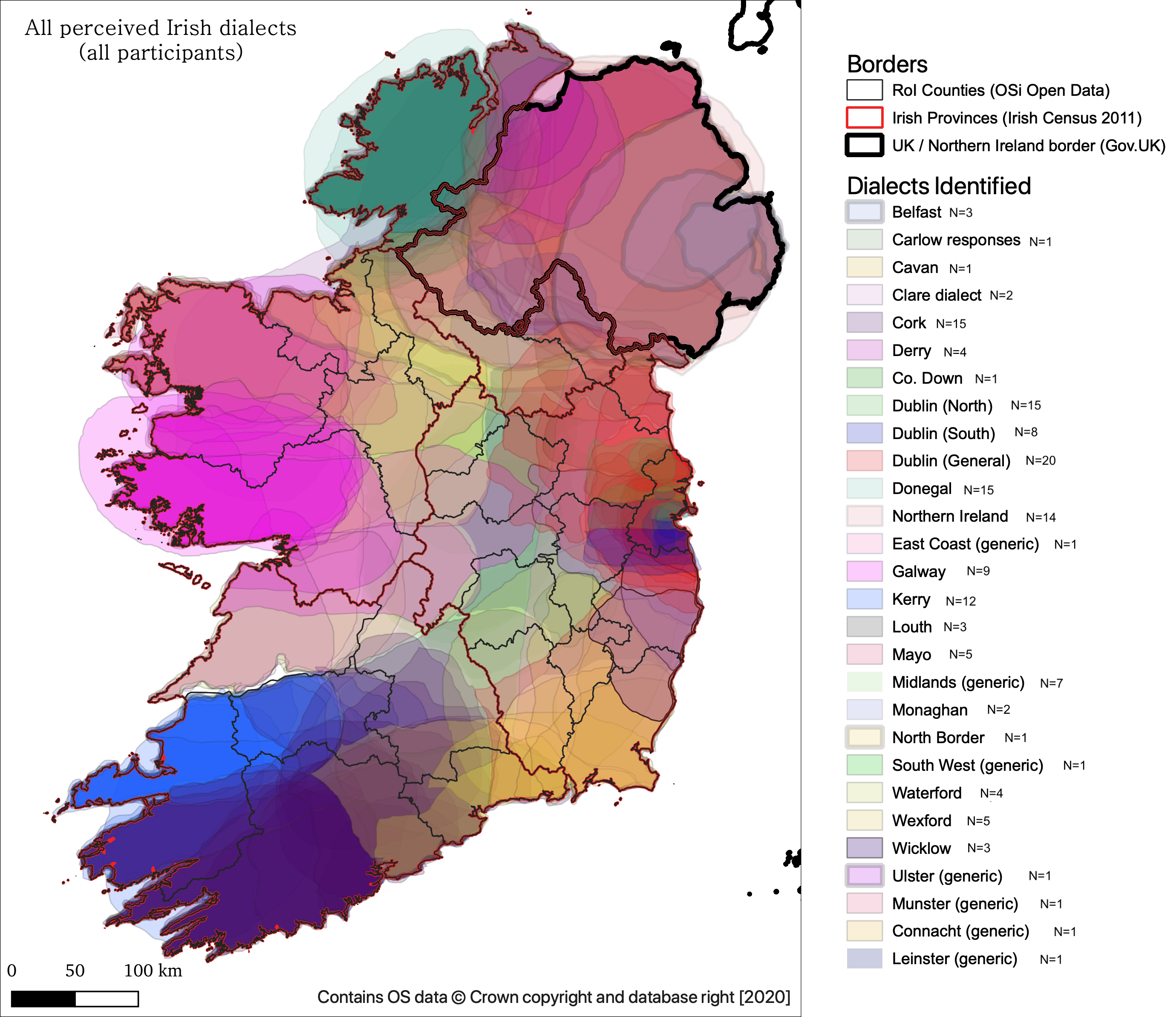
About these images
These .png files are coloured images depicting hand-drawn maps of dialect boundaries on the island of Ireland. These maps are either referred to or used in greyscale in:
Garnett, V. & Lucek, S. (forthcoming) "Perceptual Dialectology between Varieties of Irish English: Towards an Isogloss of Linguistic Boundaries on the Island of Ireland". In Lucek, S. & Amador-Moreno, C. P. (eds) Expanding the Landscapes of Irish English Research: Papers in Honour of Jeffrey Kallen. Routledge.
Date of collection: 2015-09-25
Location of data collection: Trinity College Dublin, Dublin 2, IRELAND
Funding: EU Researchers Night 2015 - Discover Research Dublin (Trinity College Dublin, Science Gallery)
SHARING/ACCESS Information
Licenses placed on the Data: CC-BY 4.0 (https://creativecommons.org/licenses/by/4.0/deed.ast)
Publications related to this data:
* Lucek, S., & Garnett, V. (2020). Perceptions of linguistic identity among Irish English speakers. In Irish Identities: Sociolinguistic Perspectives (Vol. 18, p. 104). De Gruyter.
File list:
- All Ireland Dialects.png
- f11.1 Dublin dialects (all participants).png
- f11.2 Northern Ireland dialects (all participants).png
- f11.3 Ulster Dialects (all participants).png
Any questions about these images can be sent to Vicky Garnett (garnettv@tcd.ie) or Stephen Lucek (stephen.lucek@ucd.ie)
Files
Files
(5.9 MB)
| Name | Size | Download all |
|---|---|---|
|
md5:84eebb3ca08ced6d7aeea458f9b2c7d7
|
2.4 MB | Download |
|
md5:e0dd17063a08316cf779e28fd5d6a158
|
910.6 kB | Download |
|
md5:da8c57eccdfd8d9aff50f7e9cac0cf8f
|
997.1 kB | Download |
|
md5:0a0f91d4d3ca1fb0c98c777cbc7f41de
|
1.6 MB | Download |
.png?download=1)
.png?download=1)
.png?download=1)