
Published September 23, 2025
| Version v2.1.0
Software
Open
InSAR Explorer
Creators

- 1. Institute of Photogrammetry and GeoInformation, Leibniz University Hannover
Description
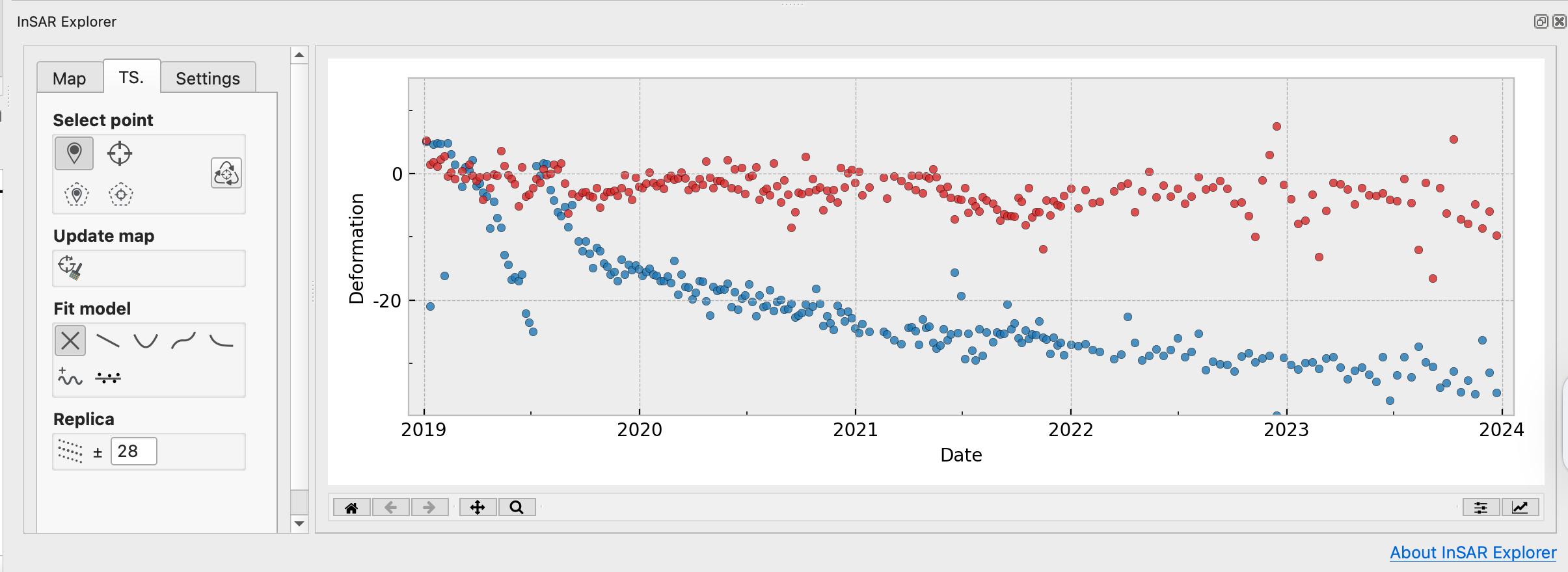
InSAR Explorer is a QGIS plugin that allows for dynamic visualization and analysis of InSAR time series data.
For more information, visit the InSAR Explorer Github repository and the InSAR Explorer page on QGIS Plugins. The file insar-exlorer_sample-data.zip provides sample data containing time series data for testing the software.
| Sample data |
Software | File formats |
Credit |
| sarvey_nordstrand_sen_a117_coh70_ts.zip | SARvey | shapefile | Andreas Piter, 2024, contains modified Copernicus Sentinel data 2016-2022, processed by ESA. |
| gmtsar_xiaodian_sen.zip | GMTSAR | grd | Wei Tang, 2024, contains modified Copernicus Sentinel data 2017-2024, processed by ESA. |
| egms_stuttgart.zip | EGMS | csv and gpkg | Generated using European Union's Copernicus Land Monitoring Service information |
| sarscape_sample_timeseries_results.zip | SARscape | shapefile | Generated using Copernicus Sentinel-1 data, processed by sarmap through SARscape 6.0 |
Files
InSAR Explorer Screenshotv2.1.0.png
Files
(209.9 MB)
| Name | Size | Download all |
|---|---|---|
|
md5:917c40f412d8f0b279d42b1276c7231b
|
27.1 MB | Preview Download |
|
md5:be058e27afaf5af85587b8df87f32b58
|
145.5 MB | Preview Download |
|
md5:90bb738ef661c8b81178fcf34f19f163
|
220.1 kB | Preview Download |
|
md5:ce7147a5145c203b2c40141dafbc8558
|
464.2 kB | Preview Download |
|
md5:5fa1654774b27f7f33d9908b642da1db
|
21.1 MB | Preview Download |
|
md5:bb6759c0a01d8f24d56b3e95553c7803
|
15.5 MB | Preview Download |
Additional details
Software
- Repository URL
- https://github.com/luhipi/insar-explorer
- Programming language
- Python