IMPMCT: A Dataset of Integrated Multi-source Polar Meso-Cyclone Tracks
Creators
Description
Short description
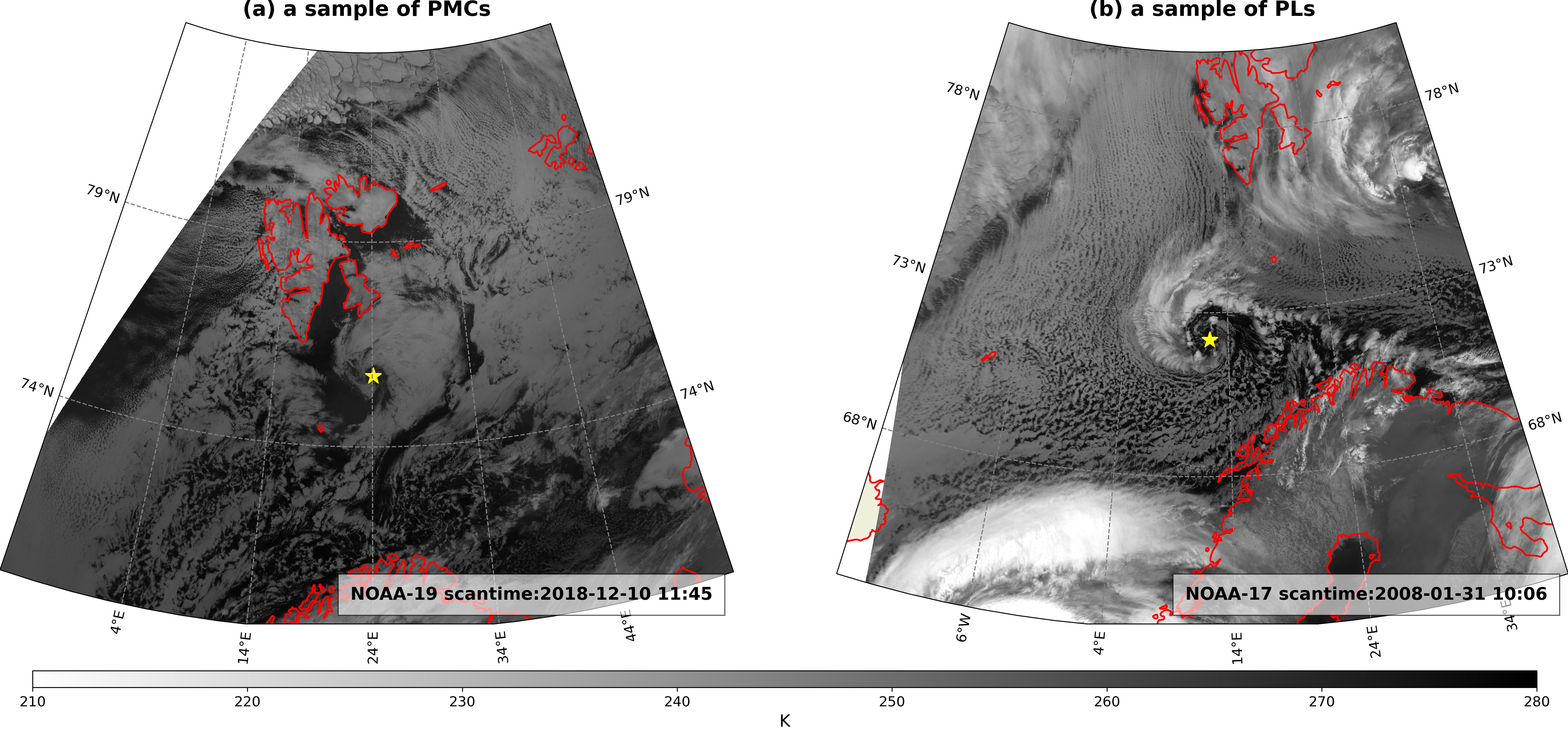
IMPMCT combines vortices tracking algorithms from ERA5 reanalysis with deep learning-based detection of cyclonic cloud features in Advanced Very High-Resolution Radiometer (AVHRR) infrared imagery, while incorporating near-surface wind matching by Advanced Scatterometer (ASCAT) and Quick Scatterometer (QUIKSCAT) measurements. The dataset contains 1,184 vortices tracks, 16,630 cyclonic cloud features, and 4373 wind speed records, with multi-dimensional attributes such as cloud morphology, core wind speed, and environmental advection wind speed.
- Temporal Coverage**: February 2001 – April 2024.
- Spatial Coverage**: 50–85°N, 40°W–80°E.
Dataset Structure
1、cyclone_IR_images
- Contains 1,185 subfolders named by cyclone IDs (matching track IDs).
- Each subfolder stores infrared images of cyclonic cloud features.
- These images are generated in the same way as the VCI image (see arcticle),but are centered on cyclone centers, with wind vectors overlaid when available.
- Naming convention: `{ID}_{step}.png` (e.g., `11_3.png`), where step denotes the temporal sequence.
- Brightness temperature mapped to grayscale (210–280 K), wind speed mapped to 0–25 m/s (examples in auxiliary folder).
2、auxiliary_information
Color mapping examples
- Mapping_of_brightness_temperature_to_grayscale.png
- Wind_speed_mapping.png
Vortex evolution logs
- split_IDs.txt: IDs of vortices formed via splitting.
- merge_IDs.txt: IDs of vortices terminated via merging.
- merge_example.png、split_example.png (illustrating merging/splitting processes).
3、Data Tables
ERA5_tracks.xlsx
| Variables | Abbreviations | Units | Notes |
| ID | ID | Track identifier | |
| Longitude | lon | °E/°W | Vortex center longitude |
| Latitude | lat | °N | Vortex center latitude |
| Time | time | UTC | Timestamp of track point |
| Smoothed relative vorticity at 850hPa | ζ_smth850 | 10^-4 s^-1 | 850 hPa relative vorticity uniformly smoothed over a 60 km radius at the vortex center |
| Vorticity equivalent radius | r | km | Equivalent circular radius of the vortex area |
| Sea level pressure center value | slp | hPa | Minimum sea-level pressure within 150km of the vort center |
| Sea level pressure center longitude | slp_lon | °E /°W | Longitude of the matched SLP minimum cente |
| Sea level pressure center latitude | slp_lat | °N | Latitude of the matched SLP minimum center |
note:The track with ID 399 differs by 3 time steps, which is connected in the cloud image but disconnected in ERA5 data
cyclone_infos.xlsx
| Variables | Abbreviations | Units | Notes |
| ID | ID | Track identifier (corresponds to vortex track) | |
| Sequence number | step | Cyclone image step at temporal sequence | |
| Longitude | lon | °E/°W | Cyclone center longitude |
| Latitude | lat | °N | Cyclone center latitude |
| AVHRR scanning time | time | UTC | Average time of AVHRR scanning within 50km of the cyclone center |
| Width of bounding box | width | km | Shorter side of the oriented bounding box circumscribing the cyclone |
| Length of bounding box | length | km | Longer side of the oriented bounding box circumscribing the cyclone |
| AVHRR satellite | AVHRR_satellite | Satellite used to draw the AVHRR infrared image | |
| Scatterometer scanning time | wind_time | UTC | Average time of wind scatterometer scanning within 50km of the cyclone center |
| Maximum near-surface wind speed associated with the cyclone | max_wind | m/s | Maximum near-surface wind speed within a short search radius of the cyclone center |
| Environmental advection near-surface wind speed | env_wind | m/s | 75th percentile of near-surface wind speed within a long search radius of the cyclone center |
| Effective ratio of wind speed | valid_fraction | Proportion of available wind speed data within a short search radius |
Files
IMPMCT-v2.zip
Additional details
Software
- Repository URL
- https://github.com/thebluewind/IMPMCT-Integrated-Multi-source-Polar-Meso-Cyclone-Tracks
- Development Status
- Active