Svalbox-DOM_2021-0019_Brattdalen

- 1. UNIS, Radboud University
- 2. UNIS
- 3. UNIS, UiO, NCCS
- 4. Svalbox
Description
Model description:
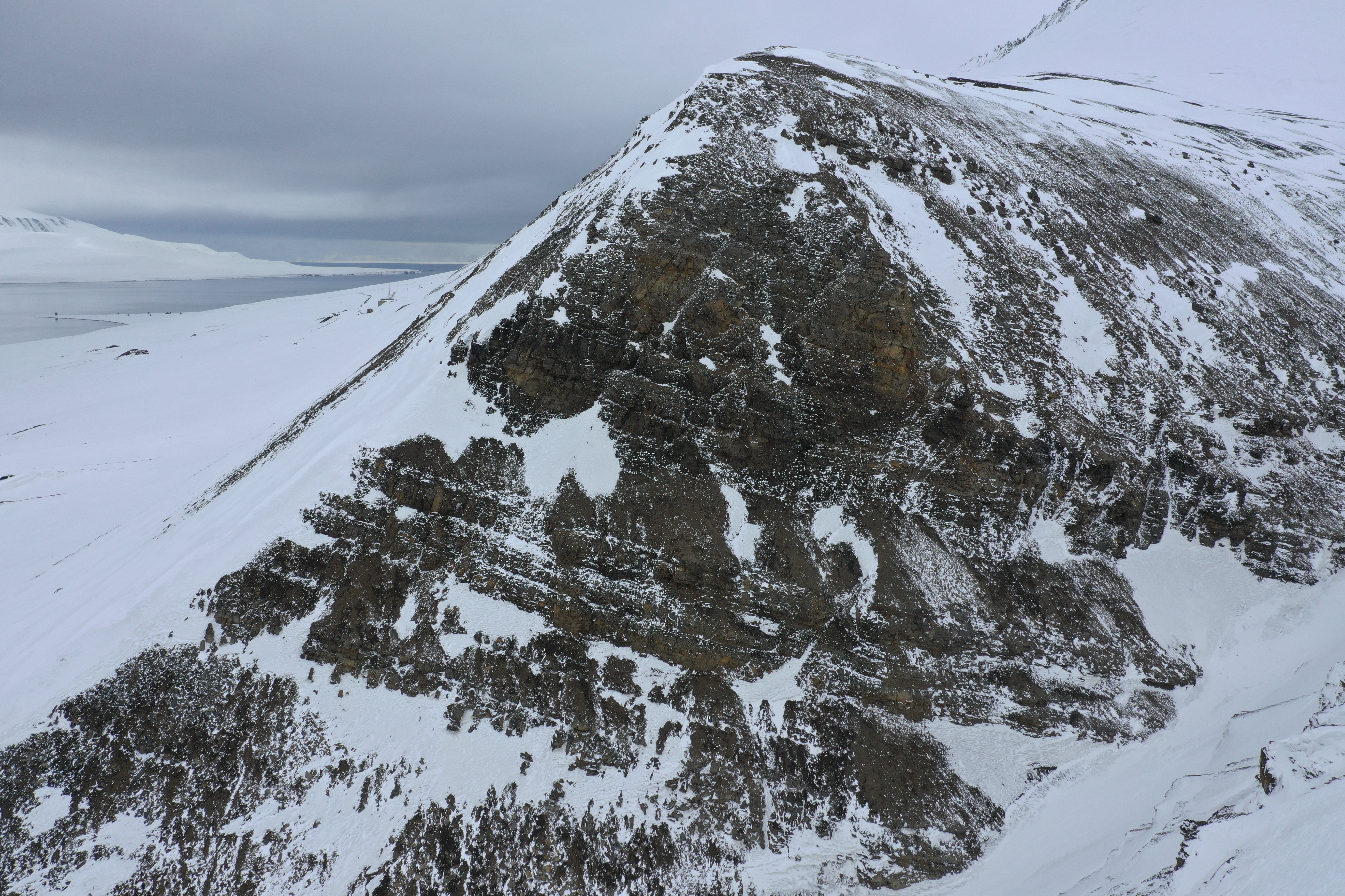
Digital outcrop model of Brattdalen, in Grønfjorden. Exhibiting outcrops of the Firkanten Fm, Basilika Fm, Grumantbyen Fm, and Hollendardalen Fm.
Data availability:
All uploaded archives are to be extracted to the same directory for a functional working environment, i.e., at the very least consisting of a project folder with the data and metashape subdirectories. The included processing report specifies the processing parameters that were used as input for the processing software (Agisoft Metashape, v1.7.2.12040).
Ground control point data use CRS epsg:4326.Exported model data use CRS epsg:32633.
Show and visualise on Svalbox.no:
Through Svalbox we aim to take geoscientific research and education to the next level – with the simple motto of placing all key information and data sets in their correct spatial position. We bring modern technology, in particular cost-effective digital outcrops, to complement more than 200 years of geoscientific research on Svalbard. Finally, Svalbox provides a sustainable platform for sharing results, workflows and teaching material with the wider geoscientific community.
For more information, contact the Svalbox team at svalbox[at]gmail.com.
Files
Brattdalen_processing_report.pdf
Files
(4.8 GB)
| Name | Size | Download all |
|---|---|---|
|
md5:d05c32554abb10e287a45fc5a57fe12e
|
946.4 kB | Preview Download |
|
md5:4f5bd60f8d3e6735c73c591ece06add2
|
2.0 GB | Preview Download |
|
md5:e64a5759095929a023ce797195cf0f0d
|
279.9 MB | Preview Download |
|
md5:04bcec2cb80964f8884cea7f2f21a852
|
10.4 MB | Preview Download |
|
md5:91fccc0f518a4dce32f03d1cddf5f327
|
2.5 GB | Preview Download |
Additional details
Dates
- Collected
-
2021-05-12Data collection.