Svalbox-DOM_2021-0002_Akseløya

- 1. UNIS, UiO, NCCS
- 2. UNIS
- 3. Svalbox
Description
Model description:
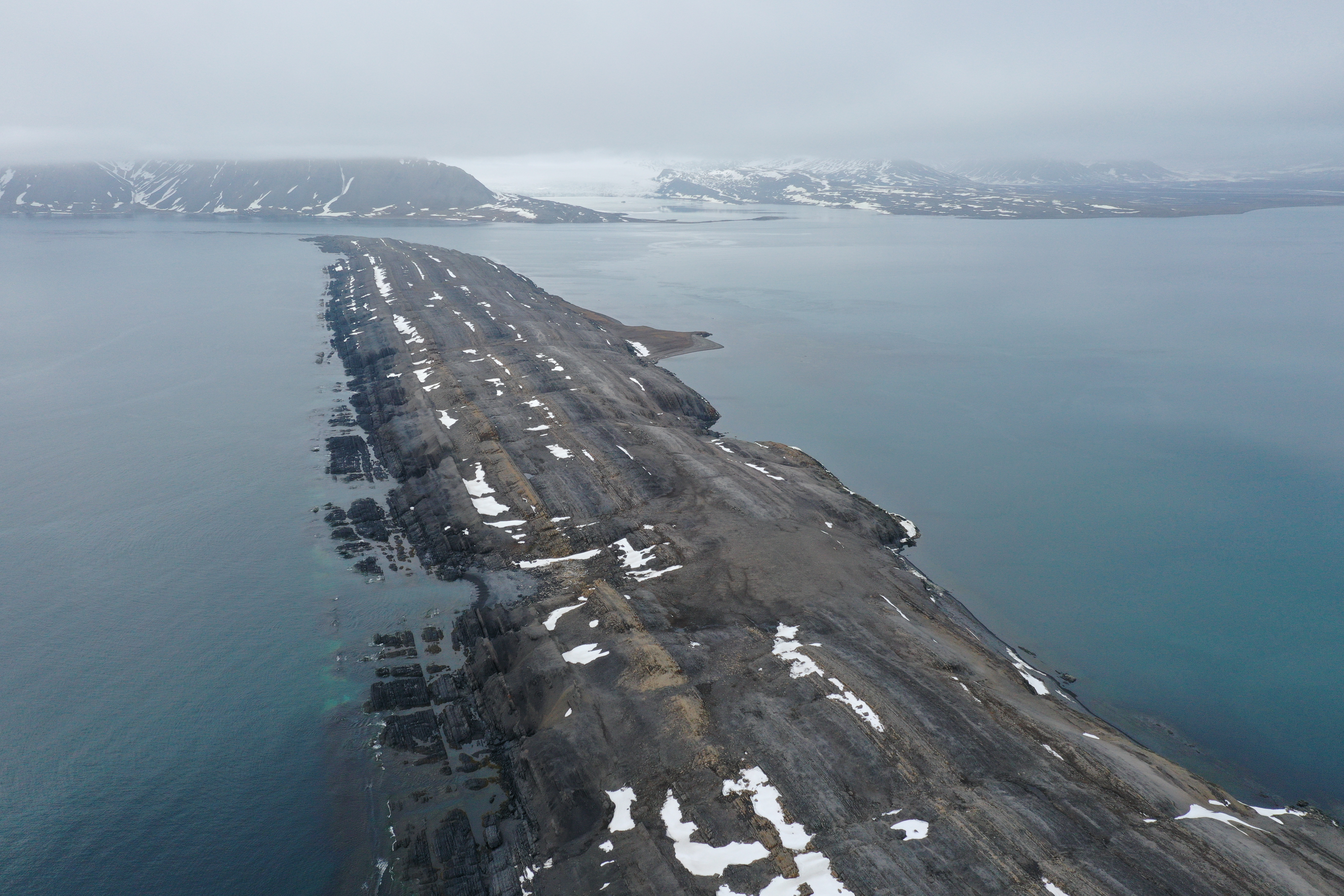
A long narrow island at the mouth of Van Mijenfjorden, central Spitsbergen. The island separates Van Mijenfjorden from Bellsund. Carbonates, limestones, shales and anhydrites make up the local strata of Upper Permian to Lower Triassic age. The strata are near-vertical owing to the collision with Greenland, forming the Spitsbergen fold and thrust belt.
Data availability:
All uploaded archives are to be extracted to the same directory for a functional working environment, i.e., at the very least consisting of a project folder with the data and metashape subdirectories. The included processing report specifies the processing parameters that were used as input for the processing software (Agisoft Metashape, v1.7.2.12040).
Exported model data use CRS epsg:32633.
Show and visualise on Svalbox.no:
Through Svalbox we aim to take geoscientific research and education to the next level – with the simple motto of placing all key information and data sets in their correct spatial position. We bring modern technology, in particular cost-effective digital outcrops, to complement more than 200 years of geoscientific research on Svalbard. Finally, Svalbox provides a sustainable platform for sharing results, workflows and teaching material with the wider geoscientific community.
For more information, contact the Svalbox team at svalbox[at]gmail.com.
Files
Akseløya_processing_report.pdf
Files
(36.9 GB)
| Name | Size | Download all |
|---|---|---|
|
md5:dd35a859f441c0ba976a601c8c8a0d1a
|
1.7 MB | Preview Download |
|
md5:e05d3c10b68e3c44b48382e14c34abe0
|
25.8 GB | Preview Download |
|
md5:0389692aa7b702739ad20f098003904d
|
357 Bytes | Preview Download |
|
md5:fbb595fc3eca5afbdc4311d4358cdc18
|
517.5 MB | Preview Download |
|
md5:07e682aca4784a4e1fc271cdd277d98c
|
7.5 MB | Preview Download |
|
md5:272ae8c258ae37d309e57721f73e1e15
|
10.6 GB | Preview Download |
Additional details
Dates
- Collected
-
2021-06-25Data collection.