Published July 24, 2015
| Version v1
Figure
Open
Figures 1–2 in The Dynastinae of the island of Saba, Dutch Caribbean (Coleoptera: Scarabaeidae)
Description
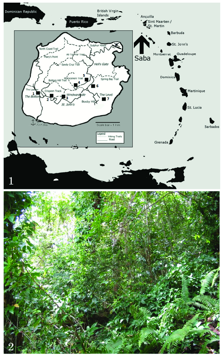
Figures 1–2. Collecting localities of Dynastinae on Saba 1) Map showing location of Saba (indicated by arrow) in the Lesser Antilles, and inset, larger-scale map of Saba, with the dynastine collecting localities numbered as follows: 1: The Bottom; 2: Crispeen track; 3: Windwardside; 4: Upper Mountain Road; 5: Lower Mountain Road; 6: English Quarter; 7: The Level. 2) Secondary hygrophilic rainforest on Maskerhorn Hill above Windwardside, Saba. Dynastines found here include Cyclocephala mafaffa and Phileurus valgus antillarum. Photograph by M. P. T. Gillett.
Notes
Files
figure.png
Files
(1.6 MB)
| Name | Size | Download all |
|---|---|---|
|
md5:a11a511c4d7a2a67878164524451c52e
|
1.6 MB | Preview Download |
Linked records
Additional details
Related works
- Is part of
- Journal article: 10.5281/zenodo.5182357 (DOI)
- Journal article: urn:lsid:plazi.org:pub:AE01FF8BFFD7314FFD00CD49FFF6FFC4 (LSID)
- Journal article: http://publication.plazi.org/id/AE01FF8BFFD7314FFD00CD49FFF6FFC4 (URL)