Continental Europe Digital Terrain Model at 30 m resolution based on GEDI, ICESat-2, AW3D, GLO-30, EUDEM, MERIT DEM and background layers
Authors/Creators

- 1. OpenGeoHub foundation
- 2. MultiOne
Description
Digital Terrain Model for Continental Europe based on the three publicly available Digital Surface Models and predicted using an Ensemble Machine Learning (EML). EML was trainined using GEDI level 2B points (Level 2A; "elev_lowestmode") and ICESat-2 (ATL08; "h_te_mean"): about 9 million points were overlaid vs MERITDEM, AW3D30, GLO-30, EU DEM, GLAD canopy height, tree cover and surface water cover maps, then an ensemble prediction model (mlr package in R) was fitted using random forest, Cubist and GLM, and used to predict most probable terrain height (bare earth). Input layers used to train the EML include:
- "lcv_bare.earth_glcf.landsat": UMD GLAD bare earth estimate for year 2010 based on Landsat time series,
- "dtm_elev.dsm_alos.aw3d": Digital Surface Model based on ALOS AW3D,
- "dtm_canopy.height_glad.umd": UMD GLAD canopy height for 2019 based on GEDI data,
- "dtm_elev.dsm_eudem.eea": Copernicus EU DEM based on the SRTM and ASTER DEMs,
- "hyd_surface.water_jrc.gswe": JRC Global Surface Water Explorer surface water probability based on the Landsat time-series,
- "lcv_landcover.12_pflugmacher2019": land cover map of Europe at 30 based on Pflugmacher et al. (2019),
- "lcv_tree.cover_umd.landsat_2000": forest tree cover for year 2000 based on the Global Forest Change data,
- "lcv_tree.cover_umd.landsat_2010": forest tree cover for year 2010 based on the Global Forest Change data,
Detailed processing steps can be found here. Read more about the processing steps here.
Training data set can be obtained in the file "gedi_elev.lowestmode_2019_eumap.RDS". The initial linear model fitted using the four independent Digital Surface / Digital Terrain models shows:
Residuals:
  Min       1Q   Median       3Q      Max
-124.627   -1.097    0.973    2.544   59.324

Coefficients:
  Estimate Std. Error t value Pr(>|t|)
(Intercept)         -1.6220640  0.0032415  -500.4   <2e-16 ***
  eu_dem25m_          -0.1092988  0.0005531  -197.6   <2e-16 ***
  eu_AW3Dv2012_30m_    0.0933774  0.0005957   156.7   <2e-16 ***
  eu_GLO30_30m_        0.2637153  0.0006062   435.1   <2e-16 ***
  eu_MERITv1.0.1_30m_  0.7496494  0.0005009  1496.6   <2e-16 ***
  ---
  Signif. codes:  0 '***' 0.001 '**' 0.01 '*' 0.05 '.' 0.1 ' ' 1

Residual standard error: 7.059 on 9588230 degrees of freedom
(2046196 observations deleted due to missingness)
Multiple R-squared:  0.9996,	Adjusted R-squared:  0.9996
F-statistic: 5.343e+09 on 4 and 9588230 DF,  p-value: < 2.2e-16
Which show that MERIT DEM (Yamazaki et al., 2019) is the most correlated DEM with GEDI and ICESat-2, most likely because it has been systematically post-processed and majority of canopy problems have been removed. Summary results of the model training (mlr::makeStackedLearner) using all covariates (including canopy height, tree cover, bare earth cover) shows:
Variable: elev_lowestmode.f
R-square: 1
Fitted values sd: 333
RMSE: 6.54

Ensemble model:
Call:
stats::lm(formula = f, data = d)

Residuals:
     Min       1Q   Median       3Q      Max
-118.788   -0.871    0.569    1.956  165.119

Coefficients:
             Estimate Std. Error t value Pr(>|t|)
(Intercept) -0.198402   0.003045  -65.15   <2e-16 ***
regr.ranger  0.452543   0.001117  405.04   <2e-16 ***
regr.cubist  0.527011   0.001516  347.61   <2e-16 ***
regr.glm     0.020033   0.001217   16.47   <2e-16 ***
---
Signif. codes:  0 '***' 0.001 '**' 0.01 '*' 0.05 '.' 0.1 ' ' 1

Residual standard error: 6.544 on 9588231 degrees of freedom
Multiple R-squared:  0.9996,	Adjusted R-squared:  0.9996
F-statistic: 8.29e+09 on 3 and 9588231 DF,  p-value: < 2.2e-16
Which indicates that the elevation errors are in average (2/3rd of pixels) between +1-2 m. The variable importance based on Random Forest package ranger shows:
Variable importance:
               variable   importance
4   eu_MERITv1.0.1_30m_ 430641370770
1     eu_AW3Dv2012_30m_ 291483345389
2         eu_GLO30_30m_ 201517488587
3            eu_dem25m_ 132742500162
9 eu_canopy_height_30m_   5148617173
7             bare2010_   2087304901
8        treecover2000_   1761597272
6        treecover2010_    141670217
The output predicted terrain model includes the following two layers:
- "dtm_elev.lowestmode_gedi.eml_mf": mean estimate of the terrain elevation in dm (decimeters) filtered using Gaussian filter and 2x pixel window in SAGA GIS,
- "dtm_elev.lowestmode_gedi.eml_md": standard deviation of the independently fitted stacked predictors quantifying the prediction uncertainty in dm (decimeters),
The predicted elevations are based on the GEDI data hence the reference water surface (WGS84 ellipsoid) is about 43 m higher than the sea water surface for a specific EU country. Before modeling, we have corrected the reference elevations to the Earth Gravitational Model 2008 (EGM2008) by using the 5-arcdegree resolution correction surface (Pavlis et al, 2012).
All GeoTIFFs were prepared using Integer format (elevations rounded to 1 m) and have been converted to Cloud Optimized GeoTIFFs using GDAL.
Disclaimer: The output DTM still shows forest canopy (overestimation of the terrain elevation) and has not been hydrologically corrected for spurious sinks and similar. This data set is continuously updated. To report a bug or suggest an improvement, please visit here. To access DTM derivatives at 30-m, 100-m and 250-m please visit here. To register for updates please subscribe to: https://twitter.com/HarmonizerGeo.
Notes
Files
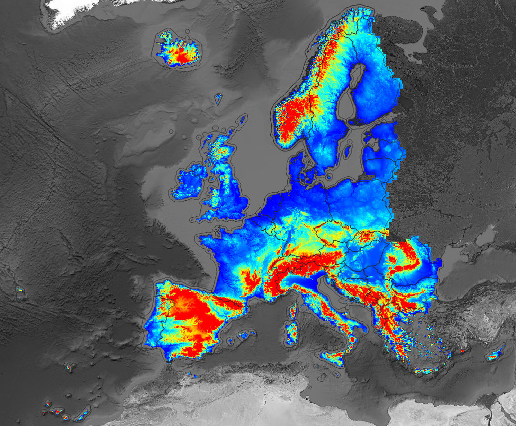
001_preview_EU_DTM.png
Files
(46.0 GB)
| Name | Size | |
|---|---|---|
|
md5:0f960837d2385943460e1721a82ba131
|
1.4 MB | Preview Download |
|
md5:b7136655458433c798b064d22d089b69
|
3.7 GB | Preview Download |
|
md5:229afa70b0878282f04c2a3b6a701876
|
9.9 GB | Preview Download |
|
md5:e1d6a6c4629e574e3987224b862e1d31
|
1.2 GB | Preview Download |
|
md5:8c0eb2d1a4b4fdf672148b80a9605fe2
|
5.0 GB | Preview Download |
|
md5:ed517e8f79c4c96c7ffa761d6df386d1
|
11.6 GB | Preview Download |
|
md5:7219b45acbd149ae1dcaa30d4d3669f2
|
1.0 GB | Preview Download |
|
md5:0a7e39cb374f26dba7eff651e69367c1
|
3.1 GB | Preview Download |
|
md5:c65dbb6bb60189a4fb466cb2360979c0
|
327.8 MB | Download |
|
md5:af37fef0c0e8ae693888c5bc737f90a5
|
998.2 MB | Preview Download |
|
md5:a4554a120b89bf3230b8e1373ca0c7b8
|
3.5 GB | Preview Download |
|
md5:e292d4800e8c8c4df40dea4b7f756478
|
1.3 GB | Preview Download |
|
md5:31ac1244c16de3a59c3e7f8b25769273
|
4.3 GB | Preview Download |
Additional details
Related works
- Is supplement to
- Dataset: 10.5281/zenodo.4486135 (DOI)
- Is supplemented by
- Dataset: 10.5281/zenodo.4058447 (DOI)
References
- Bischl, B., Lang, M., Kotthoff, L., Schiffner, J., Richter, J., Studerus, E., ... & Jones, Z. M. (2016). mlr: Machine Learning in R. The Journal of Machine Learning Research, 17(1), 5938-5942.
- Grohmann, C. H. (2018). Evaluation of TanDEM-X DEMs on selected Brazilian sites: Comparison with SRTM, ASTER GDEM and ALOS AW3D30. Remote Sensing of Environment, 212, 121-133. https://doi.org/10.1016/j.rse.2018.04.043
- Hansen, M. C., Potapov, P. V., Moore, R., Hancher, M., Turubanova, S. A., Tyukavina, A., ... & Kommareddy, A. (2013). High-resolution global maps of 21st-century forest cover change. science, 342(6160), 850-853.
- Neuenschwander, A. L., & Magruder, L. A. (2019). Canopy and terrain height retrievals with ICESat-2: A first look. Remote sensing, 11(14), 1721. https://doi.org/10.3390/rs11141721
- Pekel, J. F., Cottam, A., Gorelick, N., & Belward, A. S. (2016). High-resolution mapping of global surface water and its long-term changes. Nature, 540(7633), 418-422.
- Pflugmacher, D., Rabe, A., Peters, M., & Hostert, P. (2019). Mapping pan-European land cover using Landsat spectral-temporal metrics and the European LUCAS survey. Remote sensing of environment, 221, 583-595.
- Potapov, P., X. Li, A. Hernandez-Serna, A. Tyukavina, M.C. Hansen, A. Kommareddy, A. Pickens, S. Turubanova, H. Tang, C.E. Silva, J. Armston, R. Dubayah, J. B. Blair, M. Hofton (2020) Mapping and monitoring global forest canopy height through integration of GEDI and Landsat data. In review
- Takaku, J., & Tadono, T. (2017). Quality updates of 'AW3D'global DSM generated from ALOS PRISM. In 2017 IEEE International Geoscience and Remote Sensing Symposium (Igarss) (pp. 5666-5669). IEEE.
- Uuemaa, E., Ahi, S., Montibeller, B., Muru, M., & Kmoch, A. (2020). Vertical Accuracy of Freely Available Global Digital Elevation Models (ASTER, AW3D30, MERIT, TanDEM-X, SRTM, and NASADEM). Remote Sensing, 12(21), 3482. https://doi.org/10.3390/rs12213482
- Yamazaki, D., Ikeshima, D., Sosa, J., Bates, P. D., Allen, G. H., & Pavelsky, T. M. (2019). MERIT Hydro: a high‐resolution global hydrography map based on latest topography dataset. Water Resources Research, 55(6), 5053-5073. https://doi.org/10.1029/2019WR024873