FIGURE 3 in Cephalopods from the Cretaceous-Paleogene (K-Pg) boundary interval on the Brazos River, Texas, and extinction of the ammonites
Description
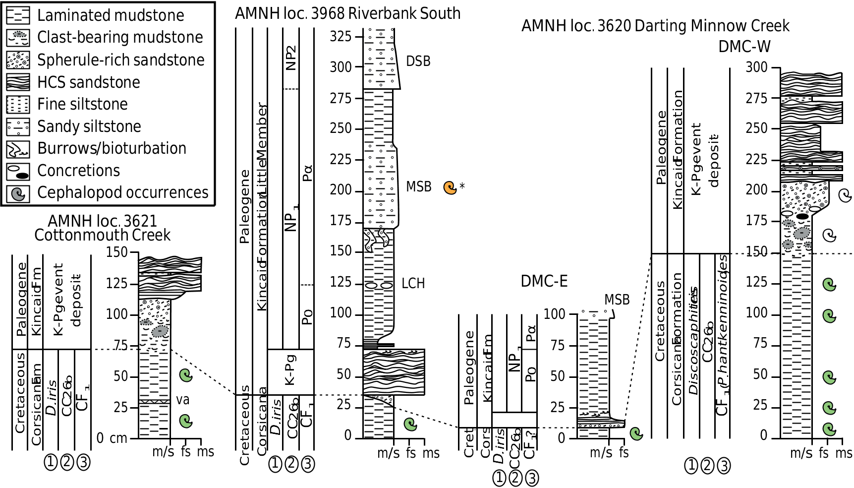
FIGURE 3. Litho- and biostratigraphic sections. K-Pg boundary shown as dashed line connecting outcrops. Biostratigraphy is illustrated for each section based on (1) ammonites, (2) calcareous nannofossils, and (3) planktonic foraminifera. Cephalopod-occurrence color code: green = Cretaceous; white = incorporated into K-Pg event deposit; orange = Paleogene. Abbreviations: DSB, Dirty Sandstone Bed; LCH, Lower Concretion Horizon; MSB, Middle Sandstone Bed; va, volcanic ash horizon at AMNH loc. 3621; * single cephalopod occurrence from the MSB (Eutrephoceras sp.) collected at Darting Minnow Creek (AMNH loc. 3620), but illustrated on the stratigraphically continuous section at AMNH loc. 3698 from Hart et al. (2012) and Leighton et al. (2017). The DSB, LCH, and MSB concretionary marker beds can be found and correlated throughout the Brazos River area (e.g., Yancey, 1996; Hart et al., 2012).
Notes
Files
figure.png
Files
(617.4 kB)
| Name | Size | Download all |
|---|---|---|
|
md5:36a79afdde7d8db5bf457c24be354e15
|
237.9 kB | Preview Download |
|
md5:7c36c21835de081bb7873f41b8073fb3
|
379.5 kB | Download |