Capturing land cover and land use with street level imagery
Authors/Creators
- 1. Joint Research Centre
- 2. INOSENS
Description
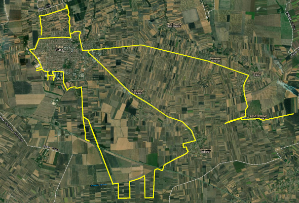
This dataset, collected in September 2018, contains street-level photographs captured by three cameras fixed on the roof of car. A field survey was focused in the Vojvodina, Serbia to more closely examine land cover/land use within croplands monitored by LandSense citizen scientists (March-September 2018).
The dataset has the following characteristics:
- Time period of data collection: Sep 2018
- Total number of photographs: 26759
- Region of interest: Vojvodina - Ruma municipality (Serbia)
Associated files: Serbia Streetlevelimagery2018 – Attributes.txt, Serbia Streetlevelimagery2018.csv, Serbia Streetlevelimagery2018.zip
This dataset is licensed under a Creative Commons Attribution 4.0 International. It is attributed to the LandSense Citizen Observatory, Joint Research Centre and InoSens.
This project has received funding from the European Union’s Horizon 2020 research and innovation programme under grant agreement no 689812.