Published July 15, 2019
| Version v1
Figure
Open
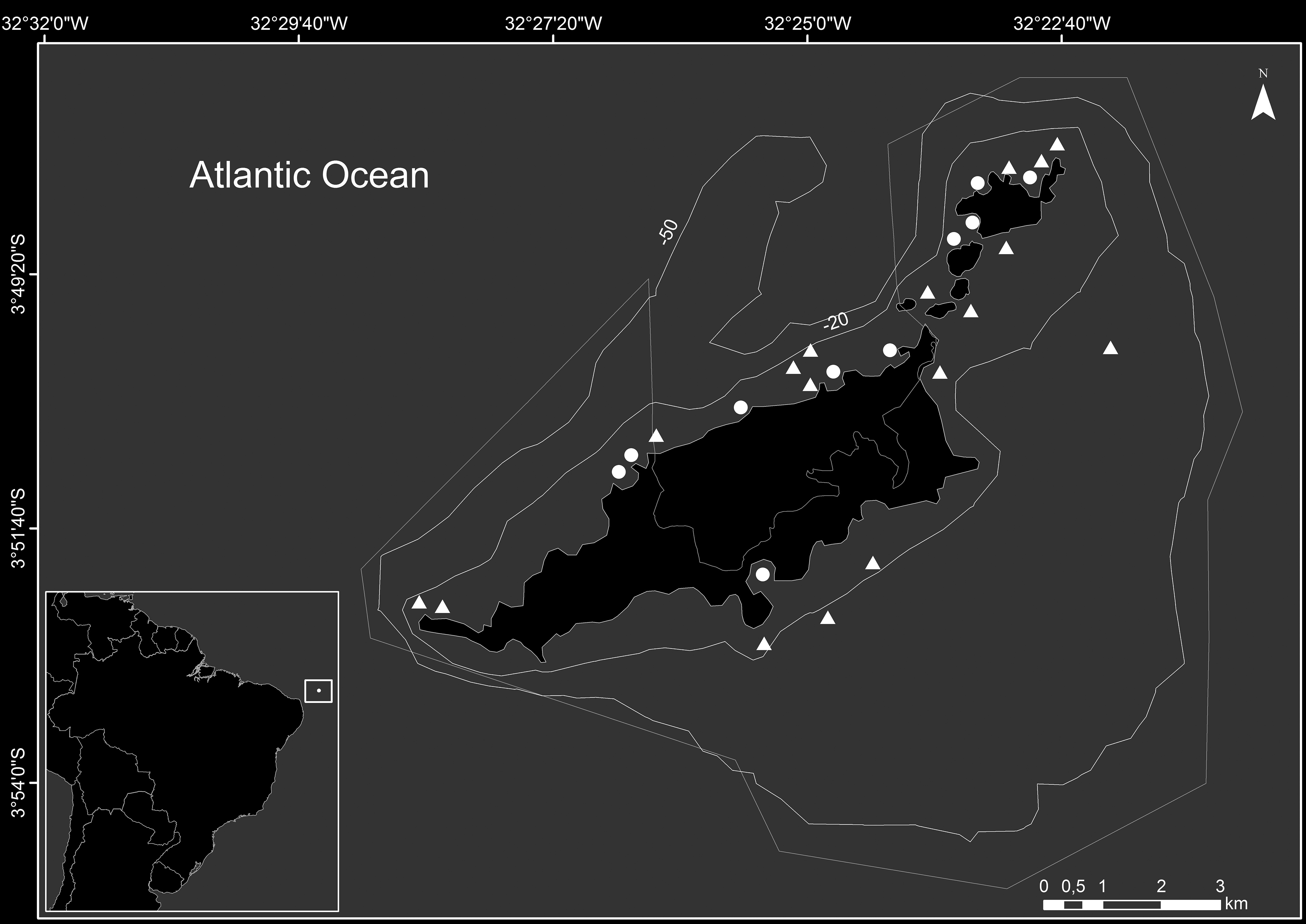
Fig. 1 in Unravelling the foraging behavior of the southern stingray, Hypanus americanus (Myliobatiformes: Dasyatidae) in a Southwestern Atlantic MPA
Description
Fig. 1. Map of the study sites in the Fernando de Noronha Arquipelago (FNA). The darker lines indicate the 20m and 50m isobaths. Inside the thinner line, there is the Marine Protected Area (MPA), while outside it, there is the Environmental Protection Area (EPA) for sustainable use. Both areas comprehend the land and insular shelf up to 50m isobaths. Circles indicate the sampling locations where focal-animal, ad libitum and intensive search methods were used; triangles indicate the sampling locations where only the intensive search method was used (see Material and Methods).
Notes
Files
figure.png
Files
(736.6 kB)
| Name | Size | Download all |
|---|---|---|
|
md5:2a5aa758388eb3994db3e70c335a73e9
|
736.6 kB | Preview Download |
Linked records
Additional details
Related works
- Is part of
- Journal article: 10.1590/1982-0224-20180131 (DOI)
- Journal article: urn:lsid:plazi.org:pub:FF85FF92BF4DFFD1FF91FF885A08EA74 (LSID)
- Journal article: https://zenodo.org/record/3668027 (URL)