Published May 29, 2019
| Version v1
Figure
Open
Figure 1 from: Montgomery AD, Fenner D, Toonen RJ (2019) Annotated checklist for stony corals of American Sāmoa with reference to mesophotic depth records. ZooKeys 849: 1-170. https://doi.org/10.3897/zookeys.849.34763
- 1. University of Hawaiʻi at Mānoa, Kāneʻohe, United States of America|U.S. Fish and Wildlife Service, Honolulu, United States of America
- 2. NOAA Fisheries Service, Pacific Islands Regional Office, Pago Pago, American Samoa
- 3. University of Hawaiʻi at Mānoa, Kāneʻohe, United States of America
Description
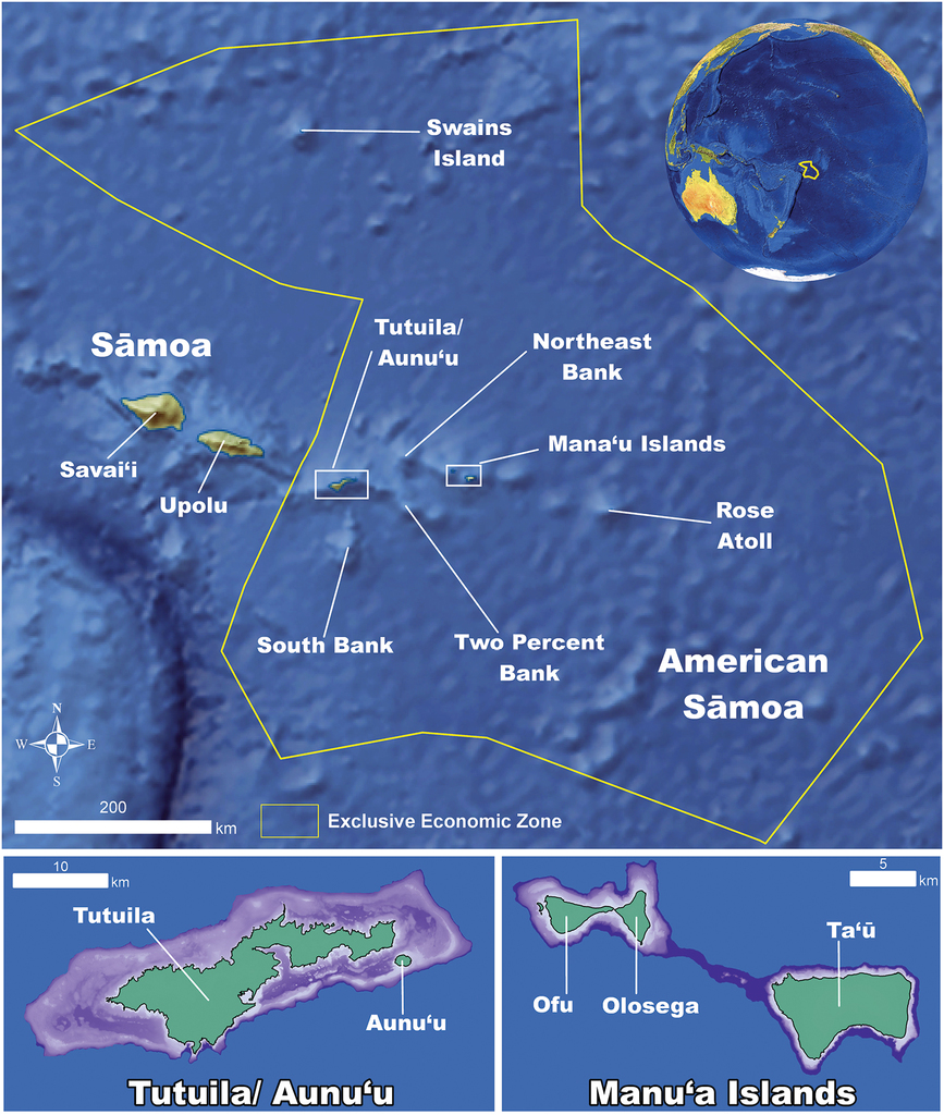
Figure 1 Map of American Sāmoa. A map of American Sāmoa showing its proximity to Independent Sāmoa and the distances between all the island groups (in green) and shallow (< 150 meter depth) banks (in purple) within the territory.
Files
big_303723.jpg
Files
(764.9 kB)
| Name | Size | Download all |
|---|---|---|
|
md5:b7ea63f254da6eca4681ecf55435fdee
|
764.9 kB | Preview Download |
Linked records
Additional details
Related works
- Is part of
- 10.3897/zookeys.849.34763 (DOI)