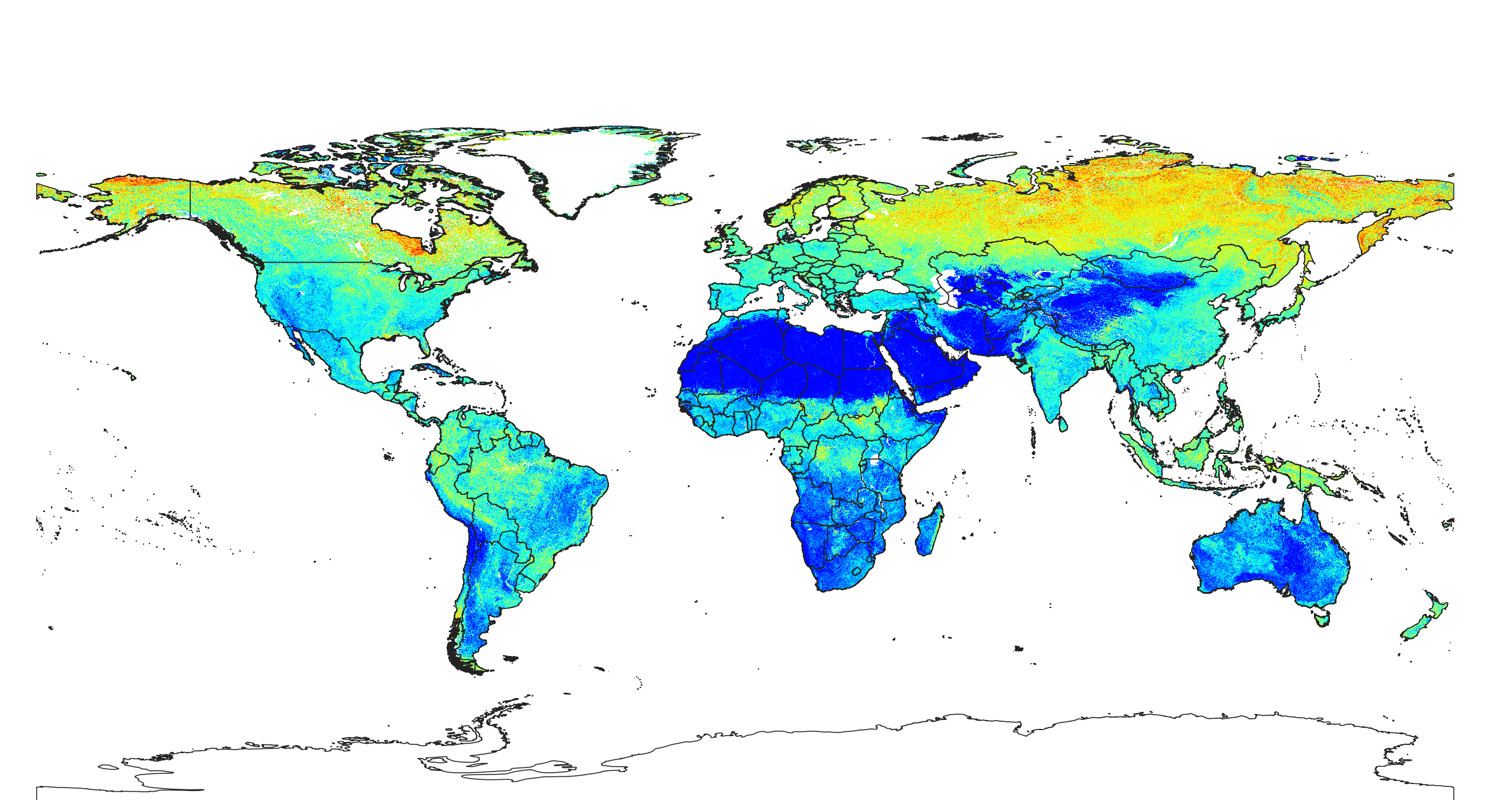
Soil available water capacity in mm derived for 5 standard layers (0-10, 10-30, 30-60, 60-100 and 100-200 cm) at 250 m resolution

Description
Available Water Capacity (in mm) derived by calculating Water Retention Difference (difference between the field capacity and wilting point; see NRCS Soil Survey Laboratory Methods Manual), and then summing up WRD for all standard layers (0–200 cm). Soil water content (volumetric) in percent for 33 kPa and 1500 kPa suctions predicted at 6 standard depths (0, 10, 30, 60, 100 and 200 cm) at 250 m resolution is available here. These estimates ignore depth to bedrock i.e. existence of any impenetrable layer (total available capacity over the whole land mass is likely about 10–15% smaller). Antarctica is not included.
To access and visualize some of the maps use: OpenLandMap.org
If you discover a bug, artifact or inconsistency in the maps, or if you have a question please use some of the following channels:
- Technical issues and questions about the code: https://gitlab.com/openlandmap/global-layers/issues
- General questions and comments: https://disqus.com/home/forums/landgis/
All files internally compressed using "COMPRESS=DEFLATE" creation option in GDAL. File naming convention:
- sol = theme: soil,
- available.water.capacity = available water capacity in mm,
- usda.mm = determination method: Water Retention Difference in mm,
- m = mean value,
- 250m = spatial resolution / block support: 250 m,
- b0..10cm = vertical reference: 0-10 cm layer below surface,
- 1950..2017 = time reference: period 1950-2017,
- v0.1 = version number: 0.1,
Files
sol_available.water.capacity_usda.mm_m_250m_0..10cm_1950..2017_v0.1.tif
Files
(23.1 GB)
| Name | Size | |
|---|---|---|
|
md5:8dfc5536bab0f7fcc82aa4b3b1e4653f
|
2.4 GB | Preview Download |
|
md5:ef0656dc5c53353f93fe85bd9855c8e9
|
1.7 MB | Preview Download |
|
md5:07129d7ed5e7d1457677bdedee926b27
|
5.5 GB | Preview Download |
|
md5:a0d08c81a2cde97083e17ac93e68a975
|
3.2 GB | Preview Download |
|
md5:f92313efdfca29d7f086c6605254a131
|
4.7 GB | Preview Download |
|
md5:80a0502f8871f256629b87f163ea8c49
|
3.5 GB | Preview Download |
|
md5:52aaa233037cac4ceacf5ae972a2148c
|
3.8 GB | Preview Download |
Additional details
References
- Bleam, W. F. (2016). Soil and environmental chemistry. Academic Press. http://dx.doi.org/10.1016/B978-0-12-804178-9.00002-1
- Hengl, T., MacMillan, R.A., (2019). Predictive Soil Mapping with R. OpenGeoHub foundation, Wageningen, the Netherlands, 370 pages, www.soilmapper.org, ISBN: 978-0-359-30635-0.