Published January 1, 2019
| Version v1
Figure
Open
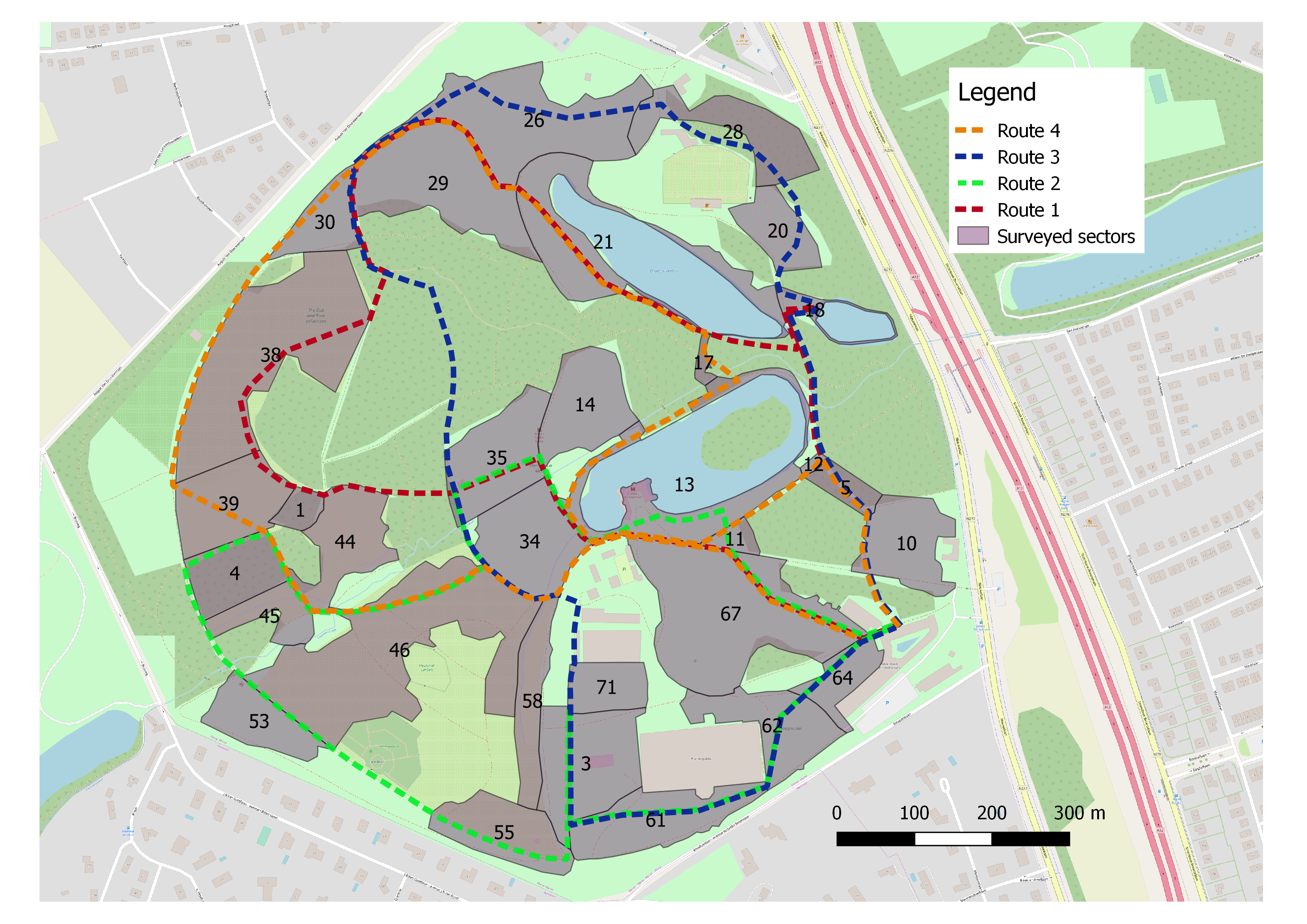
A map describing routes used in goose monitoring at Meise Botanic Garden
Description
The geese living in Meise Botanic Garden were surveyed between October 11, 2011 - July 10, 2017. Each day that the geese were monitored one route was chosen at random. This map describes those routes
routemap.png
A map of the survey routes within the Botanic Garden. CC BY-SA
The background map is derived from the OpenStreetMap see https://www.openstreetmap.org/copyright
Files
routemap.png
Files
(2.9 MB)
| Name | Size | Download all |
|---|---|---|
|
md5:98910883922e38c2131acf5982c9d4f2
|
2.9 MB | Preview Download |
Additional details
Related works
- Is supplement to
- 10.5281/zenodo.2529723 (DOI)
- 10.15468/cgffyq (DOI)