Surface water and flooding dynamics based on seasonally continuous Landsat data (1986-2011) in a dryland river basin (monthly, seasonally, and yearly animations)

Description
The animations provided here are part of the following publication:
Tulbure, M.G. and M. Broich (2018). Spatiotemporal patterns and effects of climate and land use on surface water extent dynamics in a dryland region with three decades of Landsat satellite data. Science of the Total Environment. https://www.sciencedirect.com/science/article/pii/S0048969718347466
Please refer to the above mentioned publication for a description of the data and interpretation of the patterns.
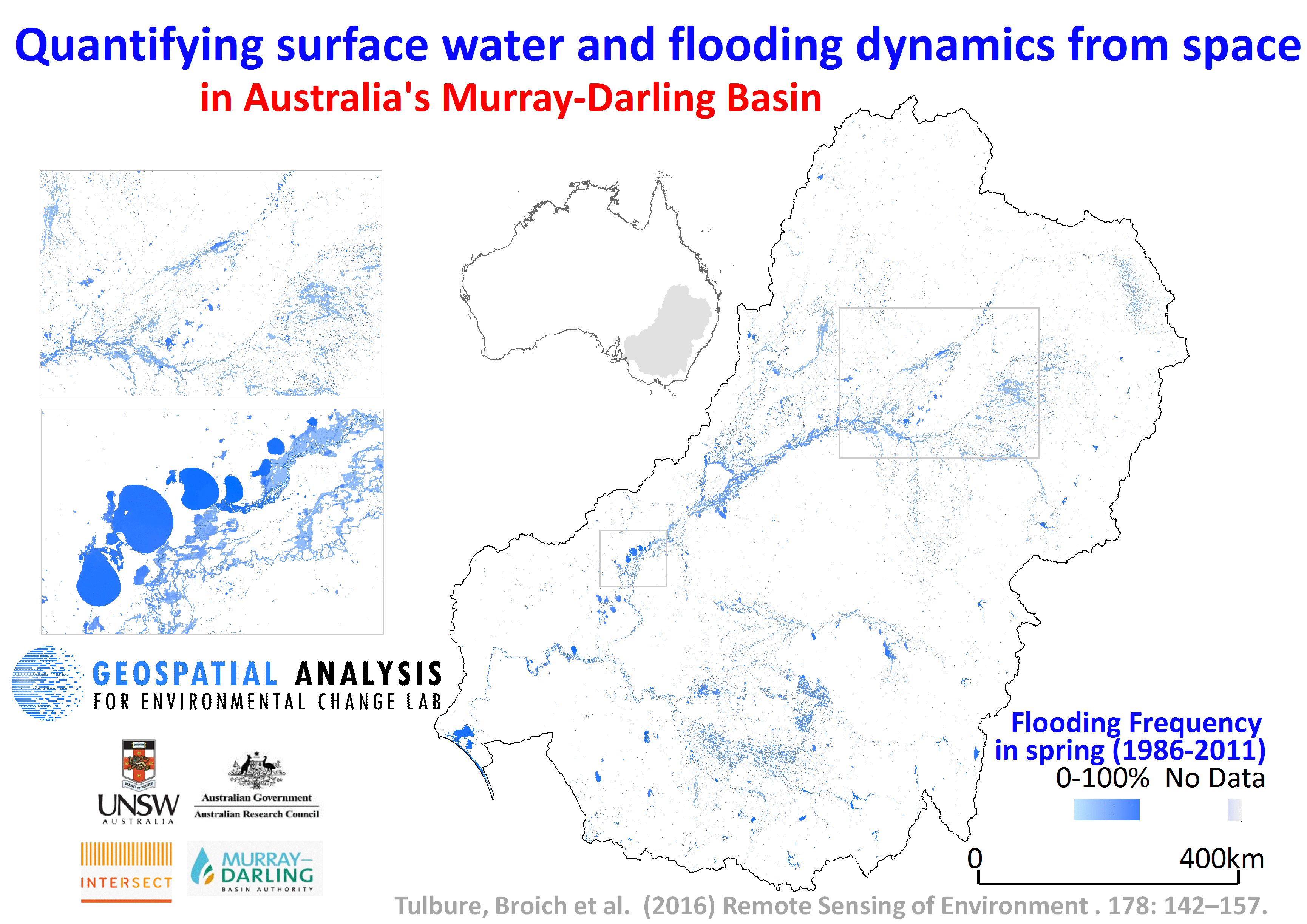
The animations are based on statistically validated surface water and flooding extent dynamics data derived from seasonally continous Landsat TM/ETM+ and random forest models from 1986 to 2011 over Australia's Murray-Darling Basin. The overall accuracy was over 99% and producer's accuracy for water 87% +/- 3%.
The method is described in the following publication:
Tulbure, M.G., M. Broich, S.V. Stehman, A. Kommareddy. (2016). Surface water extent dynamics from three decades of seasonally continuous Landsat time series at subcontinental scale in a semi-arid region. Remote Sensing of Environment. 178: 142-157 and available here: https://www.sciencedirect.com/science/article/pii/S0034425716300621
Files
Movie_S1_Tulbure_Broich_MDB_SWD_seasonaly_300dpi.gif
Additional details
Funding
References
- Tulbure, M.G. and M. Broich (2018). Spatiotemporal patterns and effects of climate and land use on surface water extent dynamics in a dryland region with three decades of Landsat satellite data. Science of the Total Environment. https://www.sciencedirect.com/science/article/pii/S0048969718347466
- Tulbure, M.G., M. Broich, S.V. Stehman, A. Kommareddy. (2016). Surface water extent dynamics from three decades of seasonally continuous Landsat time series at subcontinental scale in a semi-arid region. Remote Sensing of Environment. 178: 142-157 URL: https://www.sciencedirect.com/science/article/pii/S0034425716300621