Published November 2, 2018
| Version v0.1
Dataset
Open
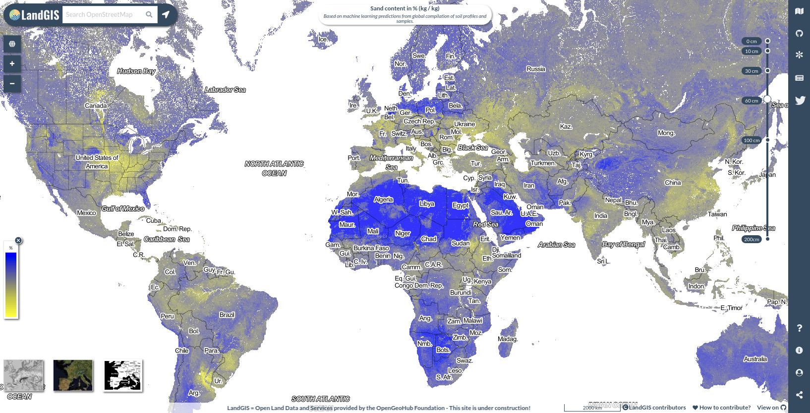
Sand content in % (kg / kg) at 6 standard depths (0, 10, 30, 60, 100 and 200 cm) at 250 m resolution

Description
Sand content in % (kg / kg) at 6 standard depths (0, 10, 30, 60, 100 and 200 cm) at 250 m resolution. Based on machine learning predictions from global compilation of soil profiles and samples. Processing steps are described in detail here. Antartica is not included.
To access and visualize maps use: https://landgis.opengeohub.org
All files internally compressed using "COMPRESS=DEFLATE" creation option in GDAL. File naming convention:
- sol = theme: soil,
- sand.wfraction = variable: sand weight fraction,
- usda.3a1a1a = determination method: laboratory method code,
- m = mean value,
- 250m = spatial resolution / block support: 250 m,
- b10..10cm = vertical reference: 10 cm depth below surface,
- 1950..2017 = time reference: period 1950-2017,
- v0.1 = version number: 0.1,
Files
landGIS_sand_content.jpg
Files
(28.6 GB)
| Name | Size | Download all |
|---|---|---|
|
md5:3d24f9804228a0f16273df42b70f0c1b
|
549.8 kB | Preview Download |
|
md5:0f26102541827e1254aef18d3dbe96b1
|
4.7 kB | Download |
|
md5:2beeb41a8b04e6bb1abeb445b28f56aa
|
2.3 GB | Preview Download |
|
md5:c1016925381700559ebf4950aeae5fac
|
2.4 GB | Preview Download |
|
md5:880f78aa189898f462296a938c06b236
|
2.4 GB | Preview Download |
|
md5:8df1ced0b4f574923fe780ac69ebfdaa
|
2.4 GB | Preview Download |
|
md5:0217867a72dce2ee3052160d6d2114b6
|
2.4 GB | Preview Download |
|
md5:5bc025cb5536c412cbaff064e1475b4f
|
2.4 GB | Preview Download |
|
md5:ae1d65e627dedc342a61ea7123c941ac
|
2.4 GB | Preview Download |
|
md5:3a3d2157e85705ac2bcc424bb096a6aa
|
2.4 GB | Preview Download |
|
md5:08ef4c053715a5765994da2cc112e056
|
2.4 GB | Preview Download |
|
md5:e07b68edb92912a2cc8bce0c50dc729f
|
2.4 GB | Preview Download |
|
md5:42b290aca57fcd1663e0adc27963e940
|
2.4 GB | Preview Download |
|
md5:dc283043c2839fef6ed7def9104b7d9e
|
2.4 GB | Preview Download |
Additional details
References
- USDA-NRCS, (2014) Laboratory Methods Manual (SSIR 42). U.S. Department of Agriculture, Natural Resources Conservation Service, National Soil Survey Center.
- Hengl T, Mendes de Jesus J, Heuvelink GBM, Ruiperez Gonzalez M, Kilibarda M, Blagotić A, et al. (2017) SoilGrids250m: Global gridded soil information based on machine learning. PLoS ONE 12(2): e0169748.