Published September 26, 2018
| Version 0.1
Dataset
Open
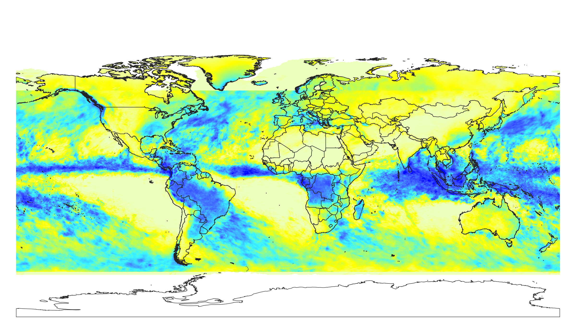
Monthly precipitation in mm at 1 km resolution based on IMERGE 2014-2018
Description
Monthly precipitation in mm based on IMERGE 2014-2018 monthly product (ftp://jsimpson.pps.eosdis.nasa.gov/NRTPUB/imerg/gis/ see files e.g. "3B-MO-L.GIS.IMERG.20180601.V05B.tif"). Downscaled to 1 km resolution using gdalwarp (cubic splines) and an average between IMERGE, WorldClim (http://biogeo.ucdavis.edu/data/worldclim/v2.0/) and CHELSA Climate (https://www.wsl.ch/lud/chelsa/data/climatologies/prec/). Antartica is not included.
To access and visualize maps use: https://landgis.opengeohub.org
If you discover a bug, artifact or inconsistency in the LandGIS maps, or if you have a question please use some of the following channels:
- Technical issues and questions about the code: https://github.com/Envirometrix/LandGISmaps/issues
- General questions and comments: https://disqus.com/home/forums/landgis/
All files internally compressed using "COMPRESS=DEFLATE" creation option in GDAL. File naming convention:
- clm = theme: climate,
- precipitation = variable: precipitation,
- imerge.oct = determination method: IMERGE long-term average values for October,
- m = mean value,
- 1km = spatial resolution / block support: 1 km,
- s0..0cm = vertical reference: land surface,
- 2014..2018 = time reference: from 2014 to 2018,
- v0.1 = version number: 0.1,
Files
clm_precipitation_imerge.annual_m_1km_s0..0cm_2014..2018_v0.1.tif
Files
(3.0 GB)
| Name | Size | Download all |
|---|---|---|
|
md5:570764f5cd066ccb89fee8cb0fe72afc
|
655.1 MB | Preview Download |
|
md5:24e12106d2c0d1511180a94ad2158a10
|
189.9 MB | Preview Download |
|
md5:79f27020bb5e67606977f432d569d784
|
201.4 MB | Preview Download |
|
md5:e4355dd5a787ef824d2650b2441d5c99
|
198.8 MB | Preview Download |
|
md5:af66ad4a6717cd021b8d167e780ebd14
|
172.4 MB | Preview Download |
|
md5:ee0fa0c5971153e9641024d97d63f5cd
|
199.0 MB | Preview Download |
|
md5:c6a38ca1fd22d02711bd5d4ad17e0fc9
|
200.6 MB | Preview Download |
|
md5:df76cebf9cf9f29413afe991840d57bb
|
195.3 MB | Preview Download |
|
md5:dc1c0467ff71cfa9e037bef2e6dd67eb
|
197.7 MB | Preview Download |
|
md5:aa553bb5af2279ec4f37403265997077
|
197.3 MB | Preview Download |
|
md5:caa8852dd9ad6ea078207a39a7e86373
|
1.8 kB | Download |
|
md5:1ae4bb5e81f24d6dbbf8e21661729c1c
|
195.9 MB | Preview Download |
|
md5:a5cdfe3447b1f5c917427ec4d7d682ee
|
206.2 MB | Preview Download |
|
md5:8a0261672cf9031258350066b823047b
|
190.3 MB | Preview Download |
|
md5:8e16e14111c9e925183e3990d0484fb6
|
2.5 MB | Preview Download |
Additional details
References
- Karger, D. N., Conrad, O., Böhner, J., Kawohl, T., Kreft, H., Soria-Auza, R. W., ... & Kessler, M. (2017). Climatologies at high resolution for the earth's land surface areas. Scientific data, 4, 170122.
- Huffman, G. J., D. T. Bolvin, D. Braithwaite, K. Hsu, R. Joyce, and P. Xie, (2014). NASA Global Precipitation Measurement (GPM) Integrated Multi-satellitE Retrievals for GPM (IMERG), Algorithm Theoretical Basis Document (ATBD). https://storm- pps.gsfc.nasa.gov/storm/IMERG_ATBD_V4.pdf
- Fick, S. E., & Hijmans, R. J. (2017). WorldClim 2: new 1‐km spatial resolution climate surfaces for global land areas. International Journal of Climatology, 37(12), 4302-4315.