Published May 14, 2016
| Version v1
Dataset
Open
Sund, Faroe Islands
Description
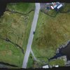
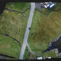
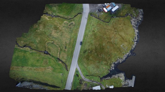
Í samband við verkætlan hjá SEV á Sundi, skrásetti Fornminnissavnið lendið við dronu. Gamli Sundsgarður lá í hesum lendinum millum áirnar, áðrenn hann varð fluttur suður um ánna. *The medieval farm of Sund was situated somewhere between these two lakes. Some of the ruins are still visible.* Model by Helgi D. Michelsen Source: Objaverse 1.0 / Sketchfab
Files
thumb0.jpeg
Files
(36.2 MB)
| Name | Size | Download all |
|---|---|---|
|
md5:5882a5d309aef79a32794157499f44f7
|
36.0 MB | Download |
|
md5:c00749db24785696e78637ab2555a322
|
1.3 kB | Preview Download |
|
md5:fb0be44d5632bfce5c26c29dcbc043be
|
3.5 kB | Preview Download |
|
md5:6a43119fc4003a549217c2b1d0ae7808
|
10.9 kB | Preview Download |
|
md5:2cf8fcd6f20e67b7fa8c0600dd6a71a3
|
22.9 kB | Preview Download |
|
md5:d9a74e2a3300bec42325aa45aaa2629d
|
44.0 kB | Preview Download |
|
md5:4f07b970851ae768f37864a8cea64bd7
|
76.8 kB | Preview Download |
|
md5:fec9067b2d84e4ea7e2f201aeee3271a
|
104.2 kB | Preview Download |