Published April 14, 2023
| Version v1
Figure
Open
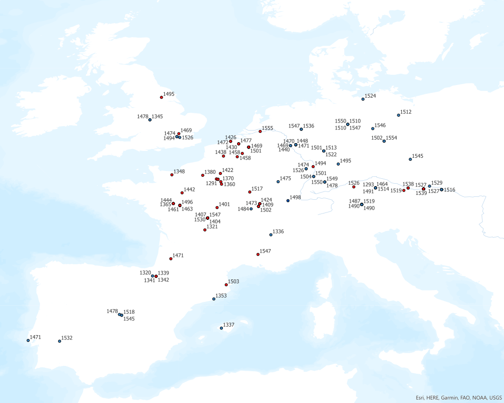
Map of Extant Court Ordinances issued between 1300-1556 in Western- and Central Europe.

Description
Map depicting the collected extant court ordinances issued between 1300 and 1556 at the Noble Courts of Western- and Central Europe. ArcGIS (Esri). Blue dots refer to court ordinances that describe ceremonial life at court. Red dots refer to court ordinances that do not describe ceremonial life at court.
See: Miara Fraikin and Meike Wiedemann, 'The "Burgundian Model" revisited: Using Digital Approaches to Explore the Reach of Burgundy', in Sanne Maekelberg and Krista De Jonge (eds.), Mapping the Space of the Early Modern Court in Europe. Functionality and Representation, 2023, pp.13-34.
Files
MapCourtOrdinances_CeremonialYES-NO.png
Files
(216.9 kB)
| Name | Size | Download all |
|---|---|---|
|
md5:81d9a3164b92b35a98f745c2f4b1749c
|
216.9 kB | Preview Download |
Additional details
Funding
References
- Miara Fraikin and Meike Wiedemann, 'The "Burgundian Model" revisited: Using Digital Approaches to Explore the Reach of Burgundy', in Sanne Maekelberg and Krista De Jonge (eds.), Mapping the Space of the Early Modern Court in Europe. Functionality and Representation, 2023, pp.13-34.