Directly-Georeferenced Hyperspectral Point Cloud (DHPC) from the Mer Bleue Peatland (example dataset)
Authors/Creators

- 1. Applied Remote Sensing Lab, Department of Geography, McGill University
- 2. National Research Council Canada, Flight Research Lab
Description
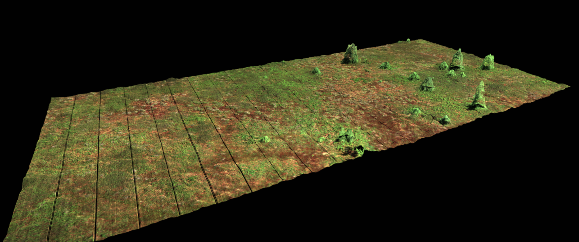
Directly-Georeferenced Hyperspectral Point Cloud (HPC_288band_xyz_final.txt) from the Mer Bleue Peatland near Ottawa, Ontario, Canada. The point cloud is accompanied by a meta data file (HPC_288band_xyz_final_META.txt) that records important data parameters such as data acquisition instrument, data acquisition time, data acquisition date, sensor platform, spectral units, wavelength and full width at half maximum of each band, wavelength units, file type and map info.
The Directly-Georeferenced Hyperspectral Point Cloud and its advantages over conventional raster data products are described in: Inamdar, D., Kalacska M., Arroyo-Mora J.P., Leblanc G., 2021. The Directly-Georeferenced Hyperspectral Point Cloud (DHPC): Preserving the Integrity of Hyperspectral Imaging Data. Frontiers in Remote Sensing doi: 10.3389/frsen.2021.675323
The methodology to generate the Directly-Georeferenced Hyperspectral Point Cloud is described in: Inamdar, D., Kalacska M., Leblanc G., Arroyo-Mora J.P. 2021. Implementation of the Directly-Georeferenced Hyperspectral Point Cloud. MethodsX Submitted.
Files
HPC_288band_xyz_final.txt.zip
Additional details
References
- Inamdar et al. (2021). The Directly-Georeferenced Hyperspectral Point Cloud (DHPC): Preserving the Integrity of Hyperspectral Imaging Data. doi: 10.3389/frsen.2021.675323
- Inamdar et al. (2021). Implementation of the Directly-Georeferenced Hyperspectral Point Cloud. MethodsX: submitted