WELCOME to the "Old Survey of India Maps" Collection
Authors/Creators
Description
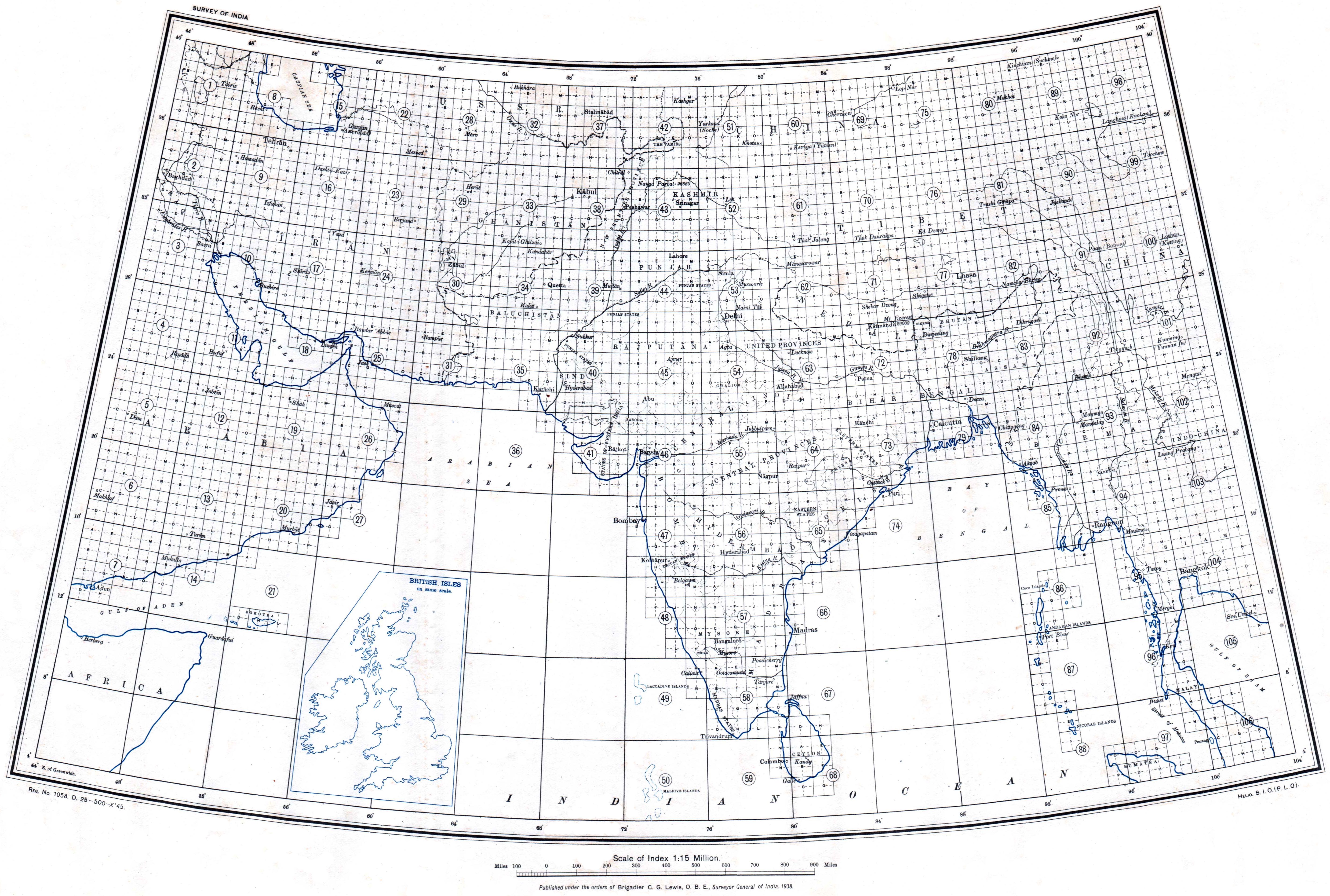
Free downloads of about 19,000 classic maps issued by the Survey of India and its descendant organizations in Pakistan, Bangladesh and Burma. The collection includes maps of Pakistan, India, Nepal, Bhutan, Bangladesh and Burma dating from the 1880s through to the 2010s, as well as some even older historical maps.
The "Map Selection and Download Spreadsheet" file below can be downloaded to provide an easy-to-use tool to view the file names of all the maps available on this website. Each of the filenames in the spreadsheet is a link to the map file, and a click on the file name will download the map to the viewers computer. This file can be stored by the viewer for future use, or, as the collection grows, an updated file can be obtained periodically from this website. The file is issued in an MS Excel format, but it can be opened by Google Sheets or other spreadsheet software.
The map collection is broken down into 19 different categories based on topic, scale and geographic area. A tab at the bottom of the spreadsheet opens the page for each category.
Files
0 Topographical Indexes of Survey of India.jpg
Files
(12.3 MB)
| Name | Size | Download all |
|---|---|---|
|
md5:a4a2038f93ce865094da10929275288f
|
2.6 MB | Preview Download |
|
md5:dd63a42722fcb4da1823f362209b0799
|
9.7 MB | Download |