Published June 9, 2021
| Version v1
Dataset
Open
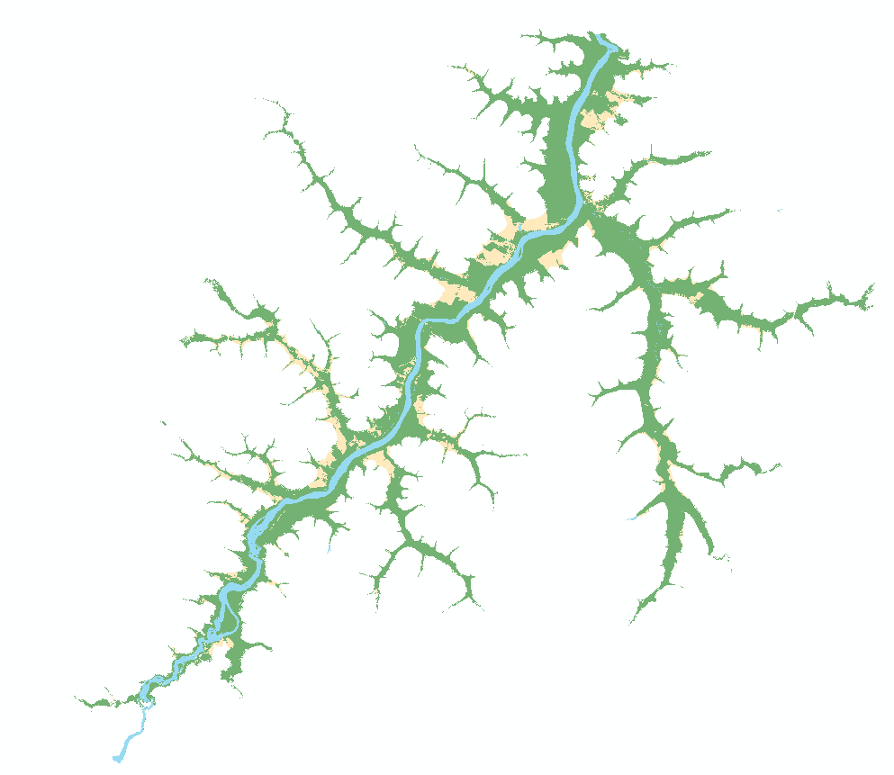
Dataset from: Before and After: A Multiscale Remote Sensing Assessment of the Sinop Dam, Mato Grosso, Brazil
Authors/Creators

- 1. Applied Remote Sensing Lab, Department of Geography, McGill University
- 2. Flight Research Lab, National Research Council Canada
- 3. Laboratório de Ictiologia de Altamira, Universidade Federal do Pará
- 4. Laboratório de Ictiologia Tropical, Universidade Federal de Mato Grosso
Description
Datasets comprising: 1) Land cover classification (ESRI shapefile) for the year 2014 for the area inundated by the Sinop hydropower plant. This classification was generated from Rapideye imagery. 2) Virtual reality viewer compatible file (.ply format) of the Ilha do Lair study area in the Teles Pires river. This 3D point cloud was generated from UAS photographs and a Structure-from-Motion Multiview Stereo workflow. It represents an area of interest for ichthyological diversity prior to the operationalization of the Sinop hydropower plant.