Toilets of Scotland

Description
Access to toilets is important for individual health and well being. Closing public toilets impacts local areas because visitors relieve themselves even if they cannot access facilities.
These data visualisations were created in response to Covid 19 which caused the closure of public toilets. They were created using QGIS with open data from OpenStreetMap and Ordnance Survey.
Mountaineering Scotland have an excellent guide on going to the toilet in the outdoors: https://www.mountaineering.scot/assets/contentfiles/pdf/where-to-go-leaflet.pdf. Please also see the outdoor access code for Scotland: https://www.outdooraccess-scotland.scot/.
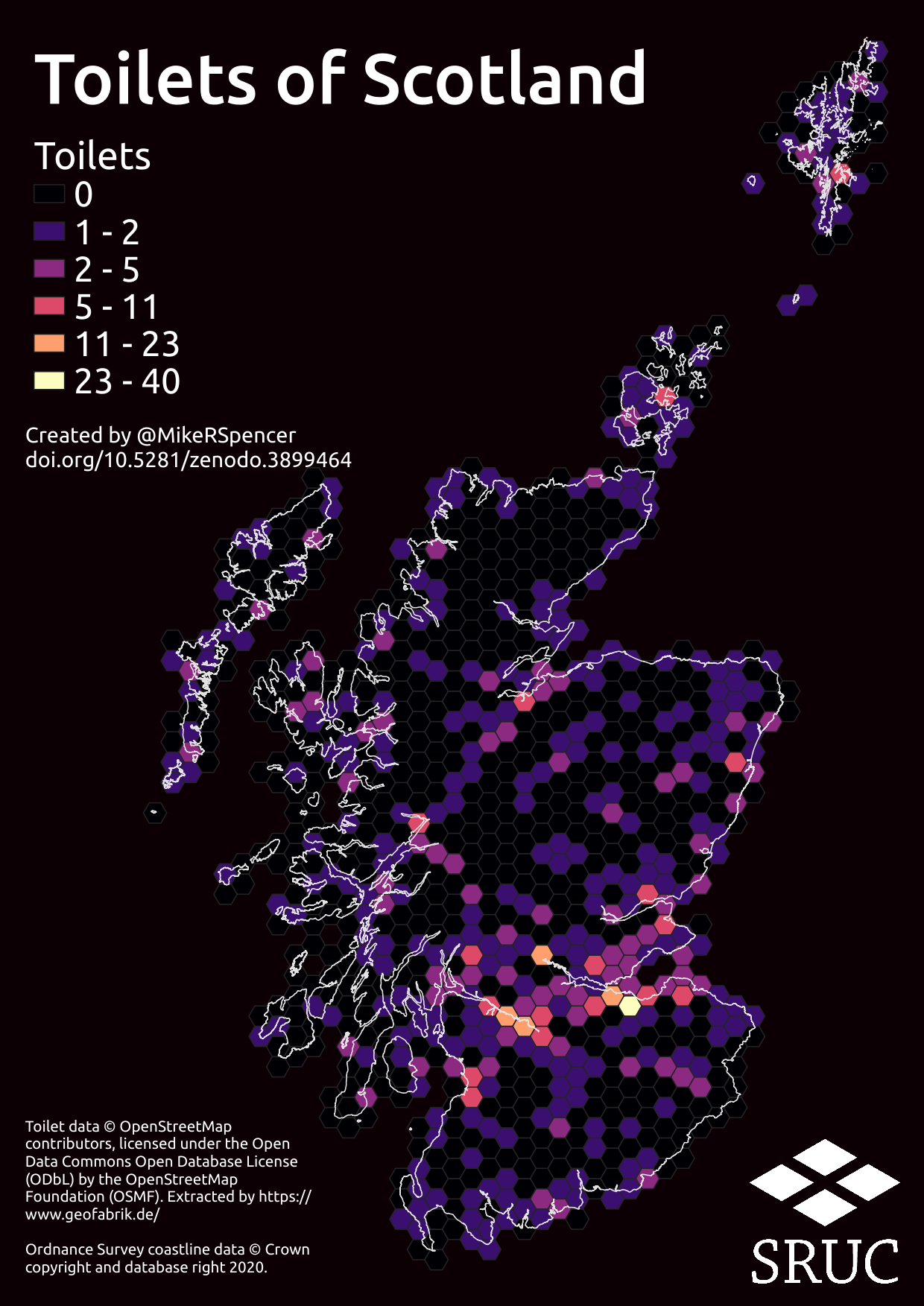
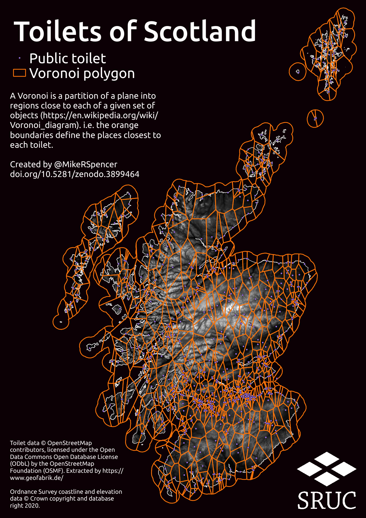
I created two maps for toilets in Scotland. Both maps use the same toilet data - taken from OpenStreetMap (https://www.openstreetmap.org). OpenStreetMap is a community project, so data are only as good as submissions in a given area.
The hex map was created by making a grid of hexagons with a diameter of approximately 6km and overlaying those over Scotland. I then counted the number of toilets within each hexagon and coloured the hexagon based on this count of toilets.
For the voronoi map I plotted the toilet locations (purple dots) and then drew lines (orange) which bisected the space between each toilet. You can read more about voronoi diagrams here: https://en.wikipedia.org/wiki/Voronoi_diagram.
If local data are missing you can contribute this information to OpenStreetMap yourself, here's a guide: https://wiki.openstreetmap.org/wiki/Beginners%27_guide.
Files
toilets_hex.png
Files
(1.9 MB)
| Name | Size | Download all |
|---|---|---|
|
md5:ab82e4c92e1940ce952b1fab594037d0
|
647.9 kB | Preview Download |
|
md5:381851dac21579be1996a0bd77cad4ad
|
1.3 MB | Preview Download |