Published December 24, 2018
| Version v0.2
Dataset
Open
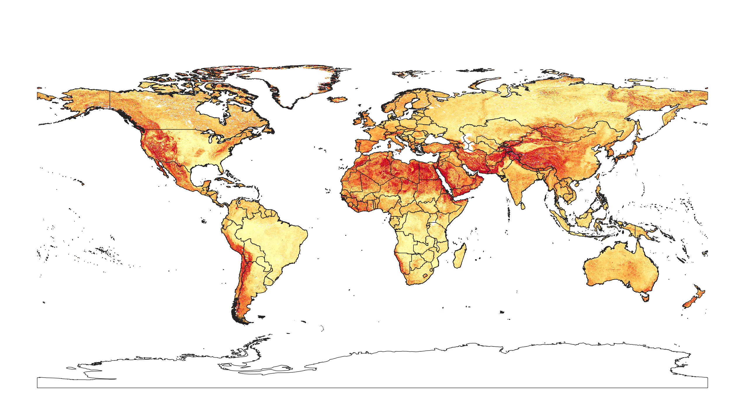
Coarse fragments % (volumetric) at 6 standard depths (0, 10, 30, 60, 100 and 200 cm) at 250 m resolution

Description
Coarse fragments % (volumetric) at 6 standard depths (0, 10, 30, 60, 100 and 200 cm) at 250 m resolution. Based on machine learning predictions from global compilation of soil profiles and samples. Processing steps are described in detail here. Antarctica is not included.
To access and visualize maps use: OpenLandMap.org
If you discover a bug, artifact or inconsistency in the maps, or if you have a question please use some of the following channels:
- Technical issues and questions about the code: https://gitlab.com/openlandmap/global-layers/issues
- General questions and comments: https://disqus.com/home/forums/landgis/
All files internally compressed using "COMPRESS=DEFLATE" creation option in GDAL. File naming convention:
- sol = theme: soil,
- coarsefrag.vfraction = variable: coarse fragments volumetric fraction,
- usda.3b1 = determination method: laboratory method code,
- m = mean value,
- 250m = spatial resolution / block support: 250 m,
- b10..10cm = vertical reference: 10 cm depth below surface,
- 1950..2017 = time reference: period 1950-2017,
- v0.2 = version number: 0.2,
Files
sol_coarsefrag.vfraction_usda.3b1_m.png
Files
(26.7 GB)
| Name | Size | |
|---|---|---|
|
md5:dffd363e9391bc96f8b4ef26edd0f88b
|
1.4 MB | Preview Download |
|
md5:b802cba715b110491ef8d598e6b7f7c8
|
2.2 GB | Preview Download |
|
md5:c0f8c7f34754f39ff6e8f5bebb4df10e
|
2.2 GB | Preview Download |
|
md5:5d9ef68764af1f0401fa9944ab1b74af
|
2.4 GB | Preview Download |
|
md5:a4ecfde064cf7fb8a193b05b1b07d513
|
2.4 GB | Preview Download |
|
md5:b3aec79e5fd0426822ad890c58ace97f
|
2.3 GB | Preview Download |
|
md5:bc64c4947641e511b68837af73eca96e
|
2.3 GB | Preview Download |
|
md5:cd253a35947c50c719faac4fc322f765
|
2.1 GB | Preview Download |
|
md5:64b51dfe2b59d21a652fd508b42fc937
|
2.1 GB | Preview Download |
|
md5:d1a4c1babdc068c340efa1e5639d2a42
|
2.2 GB | Preview Download |
|
md5:55a6466596040160755906a1bf944375
|
2.2 GB | Preview Download |
|
md5:f28004bb413d8794eae8170f053a2a9c
|
2.1 GB | Preview Download |
|
md5:5b6c71cd2a1fe7e6a52fcb98a65cb2ec
|
2.2 GB | Preview Download |
Additional details
References
- Hengl, T., MacMillan, R.A., (2019). Predictive Soil Mapping with R. OpenGeoHub foundation, Wageningen, the Netherlands, 370 pages, www.soilmapper.org, ISBN: 978-0-359-30635-0.